MyTopo
Goodells Michigan US Topo Map
Couldn't load pickup availability
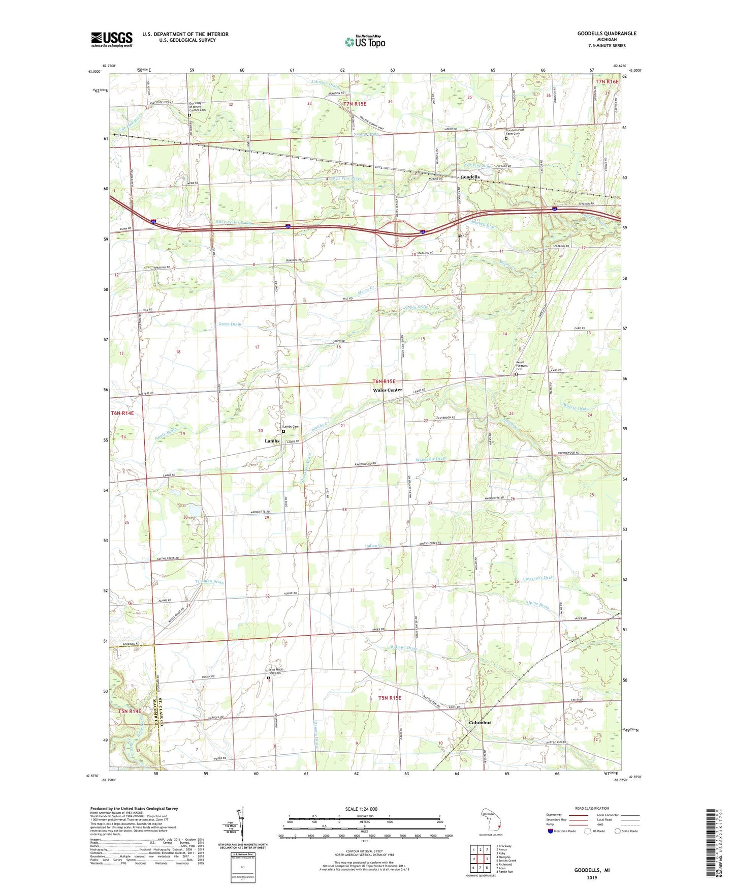
2023 topographic map quadrangle Goodells in the state of Michigan. Scale: 1:24000. Based on the newly updated USGS 7.5' US Topo map series, this map is in the following counties: St. Clair, Macomb. The map contains contour data, water features, and other items you are used to seeing on USGS maps, but also has updated roads and other features. This is the next generation of topographic maps. Printed on high-quality waterproof paper with UV fade-resistant inks.
Quads adjacent to this one:
West: Memphis
Northwest: Brockway
North: Avoca
Northeast: Ruby
East: Smiths Creek
Southeast: Rattle Run
South: Adair
Southwest: Richmond
This map covers the same area as the classic USGS quad with code o42082h6.
Contains the following named places: Apply Drain, Ashery Creek, Campbell Drain, Columbus, Columbus Post Office, Columbus Station, County Park Bible Church, First Baptist Church, Goodells, Goodells Mission, Goodells Poor Farm Cemetery, Goodells Post Office, Goodells Station, Green Drain, Hope Lutheran Church, Indian Creek, Johnson Drain, Kenockee School, Lamb Post Office, Lamb Station, Lambs, Lambs Cemetery, Lambs School, Maryglade Seminary, Moore Creek, Mount Pleasant Cemetery, Mount Pleasant Church, Neaton Drain, Our Lady of Mount Carmel Cemetery, Riley-Wales Drain, Saint Clair County, Saint Clair County Farm Museum, Saint Philip Neri Cemetery, Saint Phillip Church, Shanahan Drain, Township of Wales, Wales Center, Wales Post Office, Wales Station, Wales Township Hall Historical Marker, Wonderlic Drain, ZIP Code: 48027