MyTopo
Memphis Michigan US Topo Map
Couldn't load pickup availability
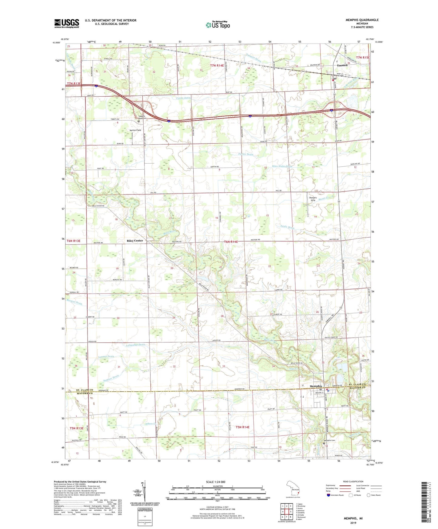
2023 topographic map quadrangle Memphis in the state of Michigan. Scale: 1:24000. Based on the newly updated USGS 7.5' US Topo map series, this map is in the following counties: St. Clair, Macomb. The map contains contour data, water features, and other items you are used to seeing on USGS maps, but also has updated roads and other features. This is the next generation of topographic maps. Printed on high-quality waterproof paper with UV fade-resistant inks.
Quads adjacent to this one:
West: Allenton
Northwest: Capac
North: Brockway
Northeast: Avoca
East: Goodells
Southeast: Adair
South: Richmond
Southwest: Armada
This map covers the same area as the classic USGS quad with code o42082h7.
Contains the following named places: All Saints Church, Beaver Creek, Belle River Golf and Country Club, Burgess Drain, City of Memphis, Cowhy Drain, Cox Doty Drain, Doyle Post Office, Doyle Station, Emmett, Emmett Fire Department, Emmett KOA Campgrounds, Emmett Post Office, Emmett Station, Fellowship Baptist Church, First United Methodist Church, Foley School, Free Methodist Church, John F Farrell Historical Marker, Loomis Drain, Memphis, Memphis Cemetery, Memphis Elementary School, Memphis High School, Memphis Medical Center, Memphis Police Department, Memphis Post Office, Memphis Public Library, Memphis Station, Memphis Volunteer Fire Department, Norton Field, Our Lady of Mount Carmel Church, Our Lady of Mount Carmel Parish Historical Marker, Parker Drain, Riley Center, Riley Center Post Office, Sage Creek, Saint Andrew Lutheran Church, Sharpe's Strip, Shaver Drain, Smith Drain, Sumner Drain, Tallmadge Drain, The Thing Historical Marker, Tibbetts Road Cemetery, Township of Riley, Village of Emmett, ZIP Code: 48041