MyTopo
Alcona Dam Pond Michigan US Topo Map
Couldn't load pickup availability
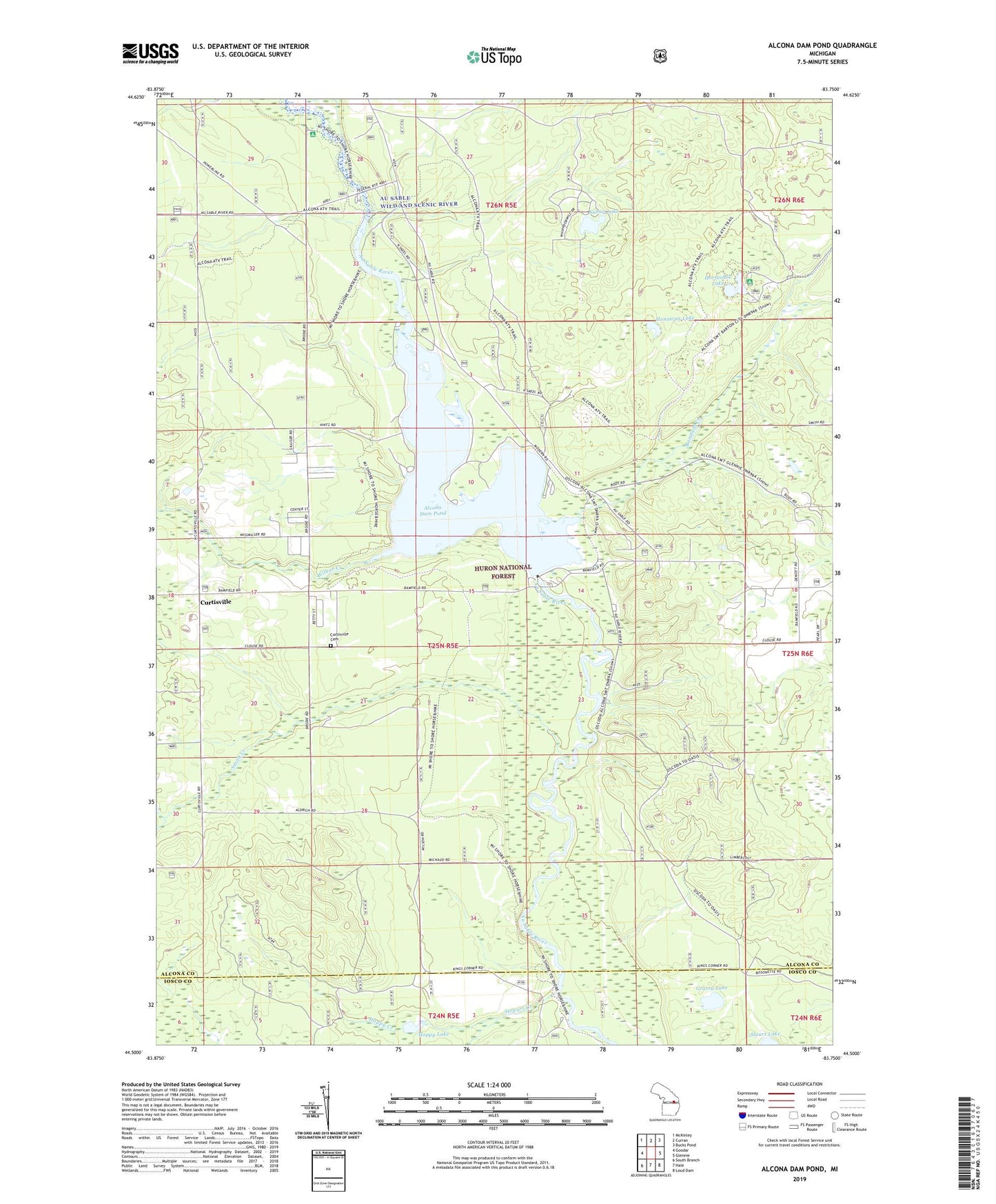
2019 topographic map quadrangle Alcona Dam Pond in the state of Michigan. Scale: 1:24000. Based on the newly updated USGS 7.5' US Topo map series, this map is in the following counties: Alcona, Iosco. The map contains contour data, water features, and other items you are used to seeing on USGS maps, but also has updated roads and other features. This is the next generation of topographic maps. Printed on high-quality waterproof paper with UV fade-resistant inks.
Quads adjacent to this one:
West: Goodar
Northwest: McKinley
North: Curran
Northeast: Bucks Pond
East: Glennie
Southeast: Loud Dam
South: Hale
Southwest: South Branch
Contains the following named places: Alcona Canoe Rental and Campground, Alcona County Park, Alcona Dam Pond, Bamfield Creek, Bamfield Post Office, Bamfield Station, Curtisville, Curtisville Cemetery, Curtisville Civic Center, Curtisville Post Office, Grassy Lake, Honawan Lake, Hoppy Creek, Hoppy Lake, Horseshoe Lake, Horseshoe Lake Campground, Penoyer Creek, Smith Creek, Stewart Creek, Sunny Lake, Township of Curtis, Wilbur Creek