MyTopo
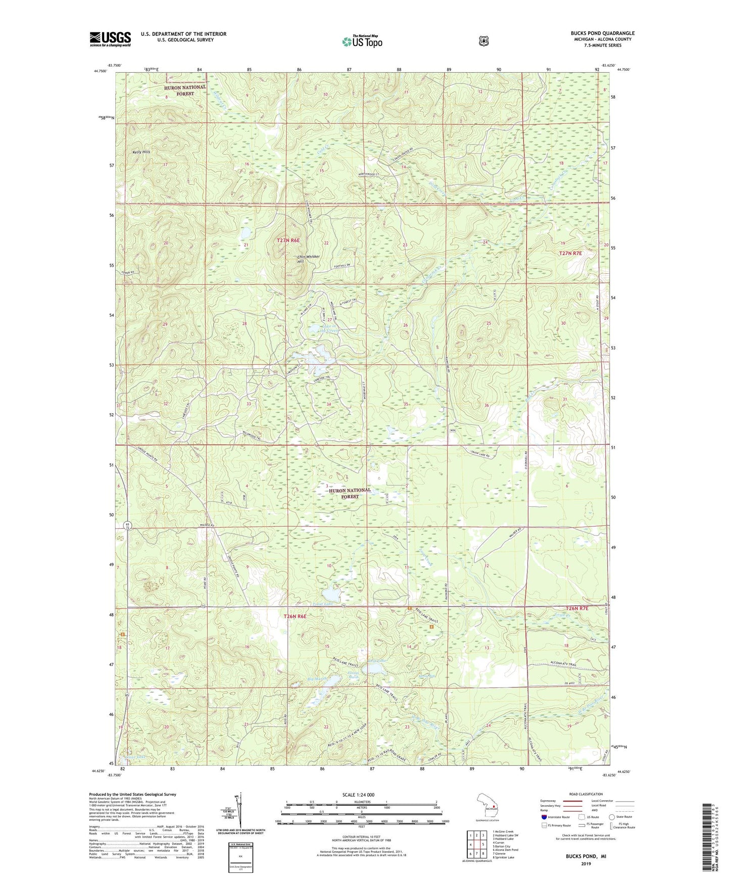
Bucks Pond Michigan US Topo Map
Couldn't load pickup availability
Also explore the Bucks Pond Forest Service Topo of this same quad for updated USFS data
2023 topographic map quadrangle Bucks Pond in the state of Michigan. Scale: 1:24000. Based on the newly updated USGS 7.5' US Topo map series, this map is in the following counties: Alcona. The map contains contour data, water features, and other items you are used to seeing on USGS maps, but also has updated roads and other features. This is the next generation of topographic maps. Printed on high-quality waterproof paper with UV fade-resistant inks.
Quads adjacent to this one:
West: Curran
Northwest: McGinn Creek
North: Hubbard Lake SW
Northeast: Hubbard Lake
East: Barton City
Southeast: Sprinkler Lake
South: Glennie
Southwest: Alcona Dam Pond
This map covers the same area as the classic USGS quad with code o44083f6.
Contains the following named places: Big Marsh, Bucks Pond, Chin Whisker Hill, Circle T Ranch Airport, Clear Lake, Cold Creek, Curran Lookout Tower, Fannys Marsh, Kelly Hills, Lake in the Green, Mossy Bog, Reid Lake, Township of Millen, Trout Lake, ZIP Code: 48705