MyTopo
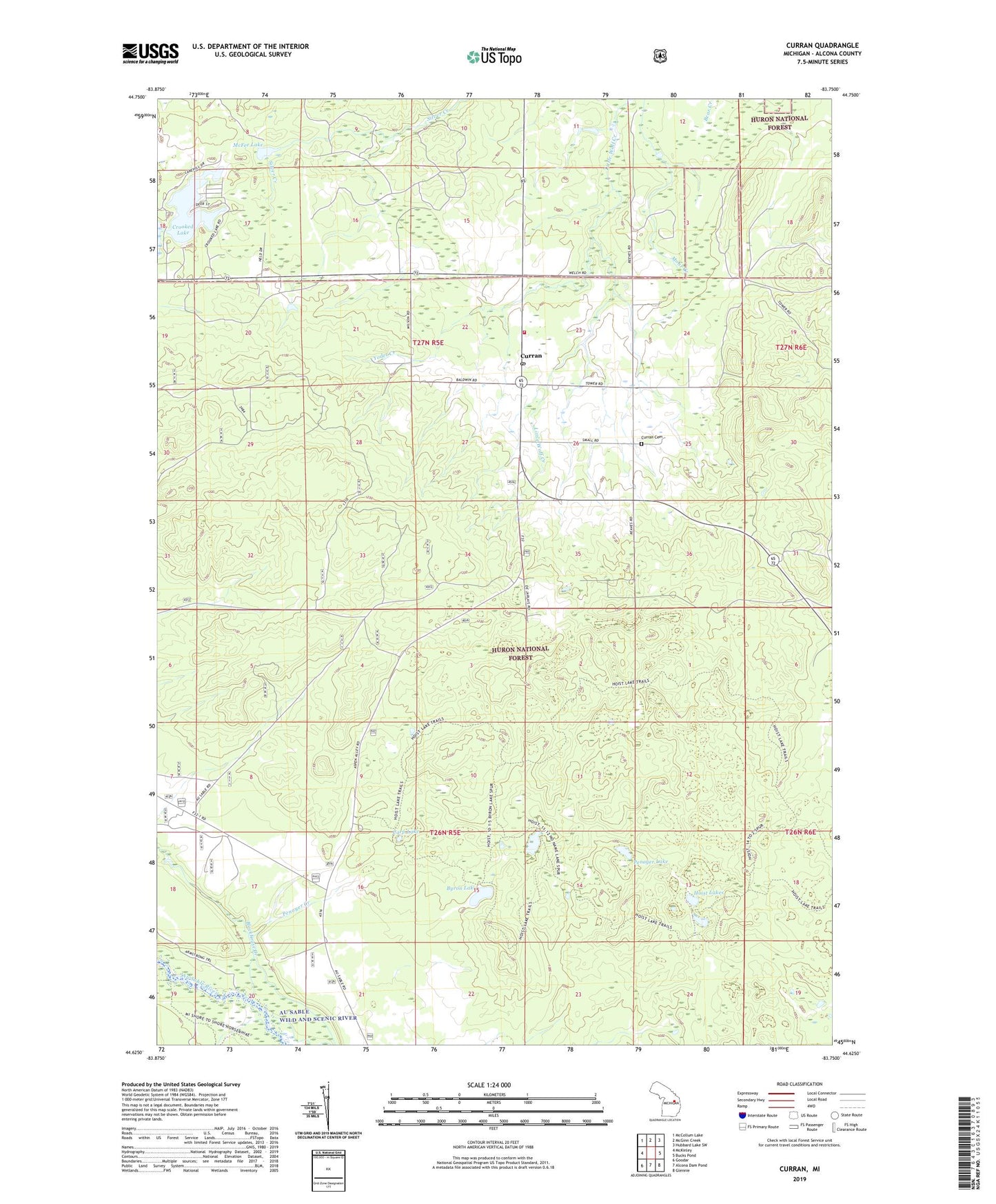
Curran Michigan US Topo Map
Couldn't load pickup availability
Also explore the Curran Forest Service Topo of this same quad for updated USFS data
2023 topographic map quadrangle Curran in the state of Michigan. Scale: 1:24000. Based on the newly updated USGS 7.5' US Topo map series, this map is in the following counties: Alcona. The map contains contour data, water features, and other items you are used to seeing on USGS maps, but also has updated roads and other features. This is the next generation of topographic maps. Printed on high-quality waterproof paper with UV fade-resistant inks.
Quads adjacent to this one:
West: McKinley
Northwest: McCollum Lake
North: McGinn Creek
Northeast: Hubbard Lake SW
East: Bucks Pond
Southeast: Glennie
South: Alcona Dam Pond
Southwest: Goodar
This map covers the same area as the classic USGS quad with code o44083f7.
Contains the following named places: Blockhouse Creek, Byron Lake, Carp Lake, Crooked Lake, Curran, Curran Cemetery, Curran Post Office, Curran Volunteer Fire Department, Hoist Lakes, McFee Lake, Mitchell Township Hall, Mitchell Township Park Picnic Area, Penoyer Lake, Rocky R Ranch Landing Strip, Sunnyside United Methodist Church, Township of Mitchell, Yoder Creek, ZIP Code: 48728