MyTopo
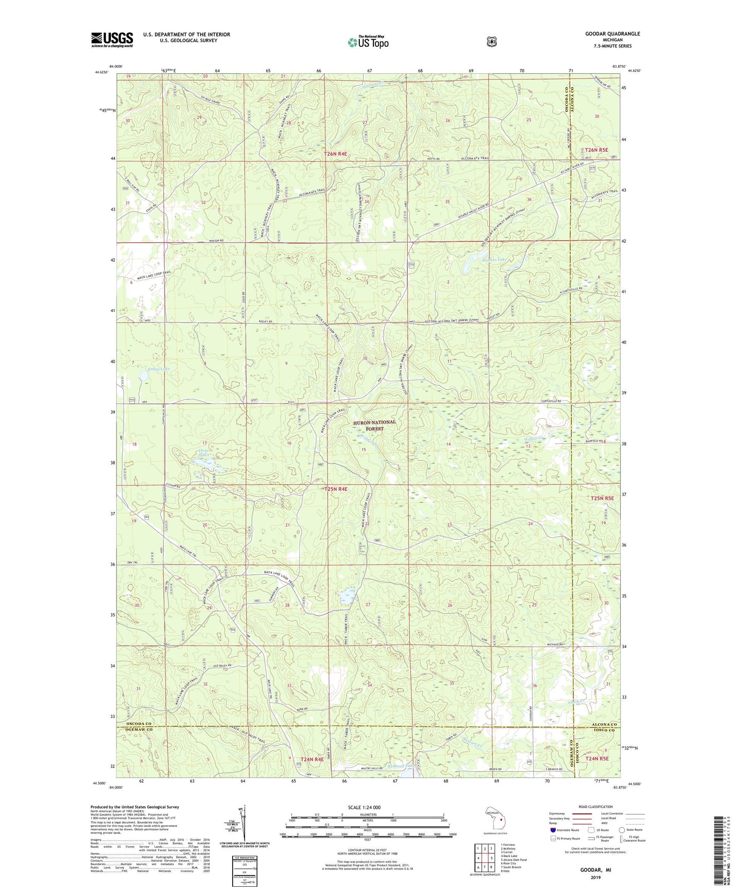
Goodar Michigan US Topo Map
Couldn't load pickup availability
Also explore the Goodar Forest Service Topo of this same quad for updated USFS data
2023 topographic map quadrangle Goodar in the state of Michigan. Scale: 1:24000. Based on the newly updated USGS 7.5' US Topo map series, this map is in the following counties: Oscoda, Alcona, Ogemaw, Iosco. The map contains contour data, water features, and other items you are used to seeing on USGS maps, but also has updated roads and other features. This is the next generation of topographic maps. Printed on high-quality waterproof paper with UV fade-resistant inks.
Quads adjacent to this one:
West: Mack Lake
Northwest: Fairview
North: McKinley
Northeast: Curran
East: Alcona Dam Pond
Southeast: Hale
South: South Branch
Southwest: Rose City
This map covers the same area as the classic USGS quad with code o44083e8.
Contains the following named places: Emley Lake, Goodar, Goodar Post Office, Hughes Lake, Huron National Forest, Redhead Lake, Three Lakes, ZIP Code: 48761