MyTopo
Bowens Mill Michigan US Topo Map
Couldn't load pickup availability
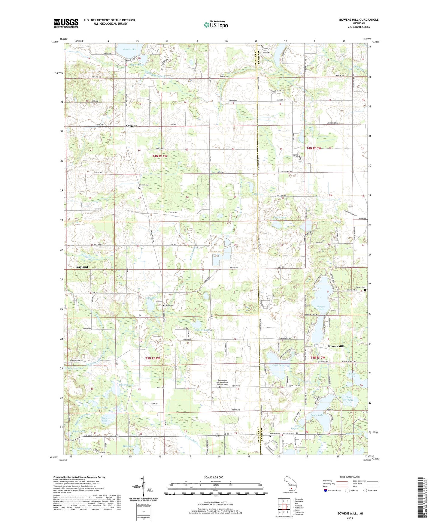
2023 topographic map quadrangle Bowens Mill in the state of Michigan. Scale: 1:24000. Based on the newly updated USGS 7.5' US Topo map series, this map is in the following counties: Allegan, Barry. The map contains contour data, water features, and other items you are used to seeing on USGS maps, but also has updated roads and other features. This is the next generation of topographic maps. Printed on high-quality waterproof paper with UV fade-resistant inks.
Quads adjacent to this one:
West: Wayland
Northwest: Cutlerville
North: Caledonia
Northeast: Alto
East: Middleville
Southeast: Cloverdale
South: Orangeville
Southwest: Martin
This map covers the same area as the classic USGS quad with code o42085f5.
Contains the following named places: Aubil Lake, Baker Lake, Barlow Lake, Bass Lake, Black Lake, Bowens Mill, Bowen's Mills Historical Marker, Bowens Mills Post Office, Camp Manitou-Lin, Chief Noonday Lake, Cobb Lake, Coman Cemetery, Corning, Corning Post Office, Cuddy Drain, Green Lake, Green Lake Calvary Church, Green Lake School, Greenlake Post Office, Hardwood Lake, Hill Cemetery, Hill Lake, Hooker Cemetery, Jackson Lake, Lansing Environmental Center, Leeks Lake, Leighton Church, Leighton Township Fire Department Station 2, Little Payne Lake, McIntire Lake, McIntire Lake Drain, Mill Pond, Mud Lake, Northbrook Mobile Home Estates, Patterson Pit, Payne Lake, Pickerel Lake, Portage Terrace Mobile Home Park, Robbins Cemetery, Round Lake, Sager Lake, Sager Lake Drain, Saint Cyril Church, Saints Cyril and Methodius' Catholic Cemetery, Scales Prairie, Squaw Lake, Tollenbar Drain, Township of Leighton, Township of Wayland, Wilson Drain, WJFM-FM (Grand Rapids), WOOD-FM (Grand Rapids), WOTV-TV (Grand Rapids), WVGR-FM (Grand Rapids), WWMT-TV (Kalamazoo), WXMI-TV (Grand Rapids), Yankee Springs Golf Course, Yankee Springs Township Fire Department, ZIP Code: 49348