MyTopo
Bulldog Lake Michigan US Topo Map
Couldn't load pickup availability
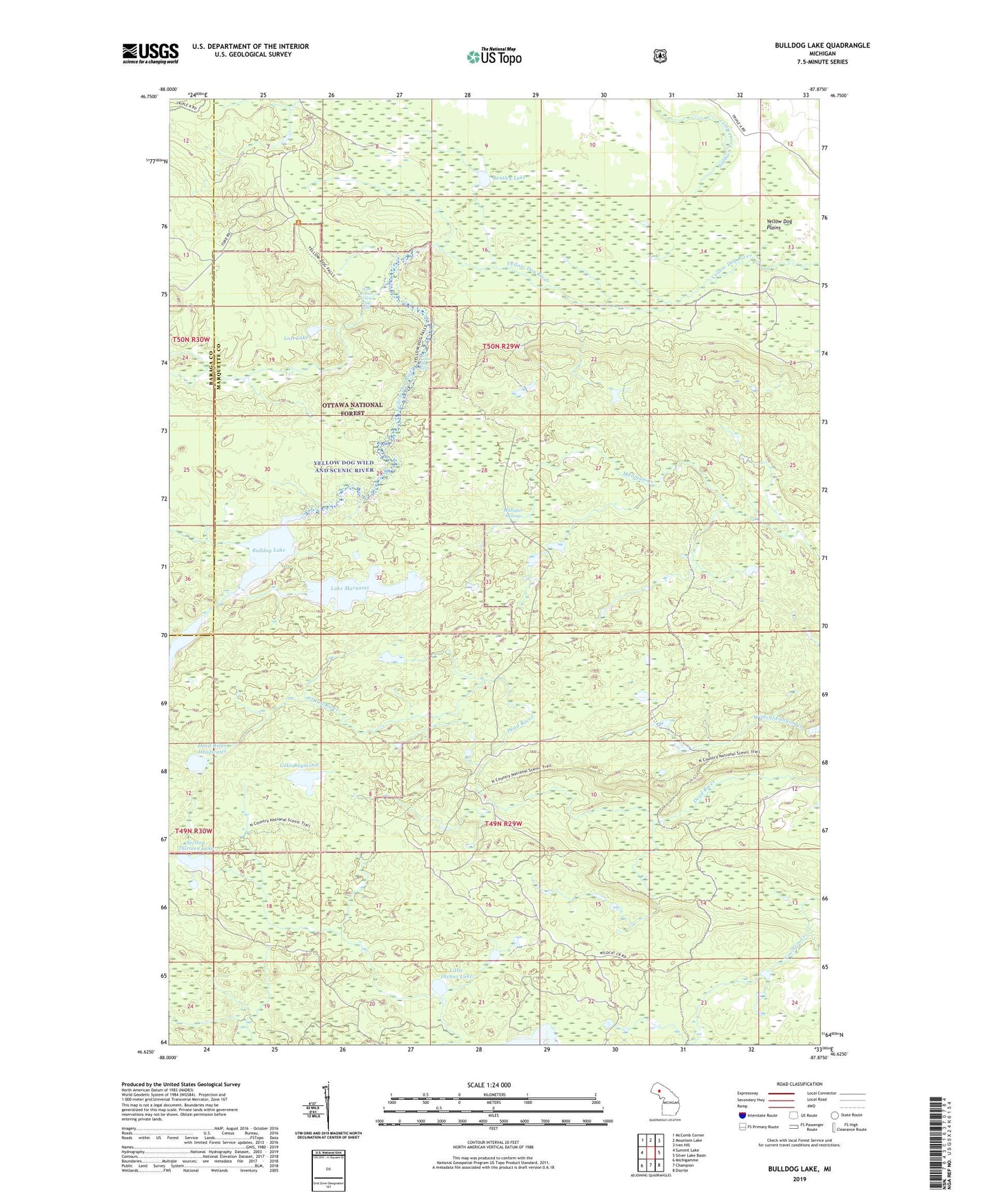
2019 topographic map quadrangle Bulldog Lake in the state of Michigan. Scale: 1:24000. Based on the newly updated USGS 7.5' US Topo map series, this map is in the following counties: Marquette, Baraga. The map contains contour data, water features, and other items you are used to seeing on USGS maps, but also has updated roads and other features. This is the next generation of topographic maps. Printed on high-quality waterproof paper with UV fade-resistant inks.
Quads adjacent to this one:
West: Summit Lake
Northwest: McComb Corner
North: Mountain Lake
Northeast: Ives Hill
East: Silver Lake Basin
Southeast: Diorite
South: Champion
Southwest: Michigamme
Contains the following named places: Anderson Creek, Beaver Pond, Bentley Lake, Bulldog Lake, Dead River Headwater, Lake Margaret, Lake Raymond, Little Dishno Lake, Lost Lake, Mulligan Swamp, North Country Trail, Section Thirteen Lake, West Branch Yellow Dog Falls, Wildcat Canyon Creek, Yellow Dog Falls, Yellow Dog Wild and Scenic River