MyTopo
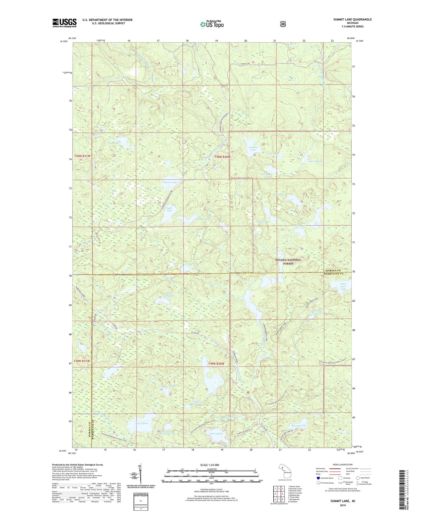
Summit Lake Michigan US Topo Map
Couldn't load pickup availability
Also explore the Summit Lake Forest Service Topo of this same quad for updated USFS data
2023 topographic map quadrangle Summit Lake in the state of Michigan. Scale: 1:24000. Based on the newly updated USGS 7.5' US Topo map series, this map is in the following counties: Baraga, Marquette. The map contains contour data, water features, and other items you are used to seeing on USGS maps, but also has updated roads and other features. This is the next generation of topographic maps. Printed on high-quality waterproof paper with UV fade-resistant inks.
Quads adjacent to this one:
West: Mount Curwood
Northwest: Skanee South
North: McComb Corner
Northeast: Mountain Lake
East: Bulldog Lake
Southeast: Champion
South: Michigamme
Southwest: Three Lakes
This map covers the same area as the classic USGS quad with code o46088f1.
Contains the following named places: Baraga Creek, Big Bear Lake, Boniface Camp, Camp Eleven Creek, Camp Eleven Lake, Cedar Lake, Charles Lake, Clear Lake, Corner Lake, Ephriam Creek, Evergreen Lake, Four Island Lake, Hasseib Lake, Hebert Lake, High Lake, Island Lake, Lake Alice, Lake Arfelin, Lake Dortay, Lake Elinor, Lake Gordon, Lake Phillips, Lake Sally Lou, Lake Vedder, Little Bear Lake, Little East Branch Huron River, Little West Branch Huron River, Lower Baraga Lake, Lower Baraga Lake Trail, McCormick Wilderness, Sawyer Lake County Park, Summit Lake, Township of Michigamme, Trout Lake, Upper Baraga Lake, Upper Baraga Lake Trail, White Deer Lake, White Deer Lake Trail