MyTopo
McComb Corner Michigan US Topo Map
Couldn't load pickup availability
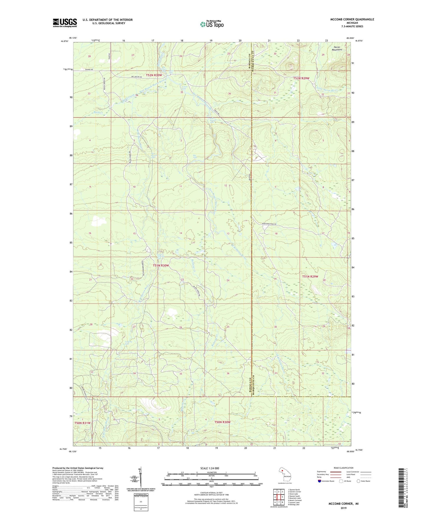
2023 topographic map quadrangle McComb Corner in the state of Michigan. Scale: 1:24000. Based on the newly updated USGS 7.5' US Topo map series, this map is in the following counties: Baraga, Marquette. The map contains contour data, water features, and other items you are used to seeing on USGS maps, but also has updated roads and other features. This is the next generation of topographic maps. Printed on high-quality waterproof paper with UV fade-resistant inks.
Quads adjacent to this one:
West: Skanee South
Northwest: Skanee North
North: Glovers Corner
Northeast: Howe Lake
East: Mountain Lake
Southeast: Bulldog Lake
South: Summit Lake
Southwest: Mount Curwood
This map covers the same area as the classic USGS quad with code o46088g1.
Contains the following named places: Big Erick's Falls, Big Eric's Bridge State Forest Campground, Big Falls, Black Creek, East Branch Falls, East Branch Huron River, Ectasy Falls, Eliason Camp, Elmblad Camp, Erickson Camp, Letherby Falls, Lower Falls, Lower Letherby Falls, McComb Corner, Northwood Camp, Robarge Creek, Sirard Camp, West Branch Falls, West Branch Huron River