MyTopo
Butternut Michigan US Topo Map
Couldn't load pickup availability
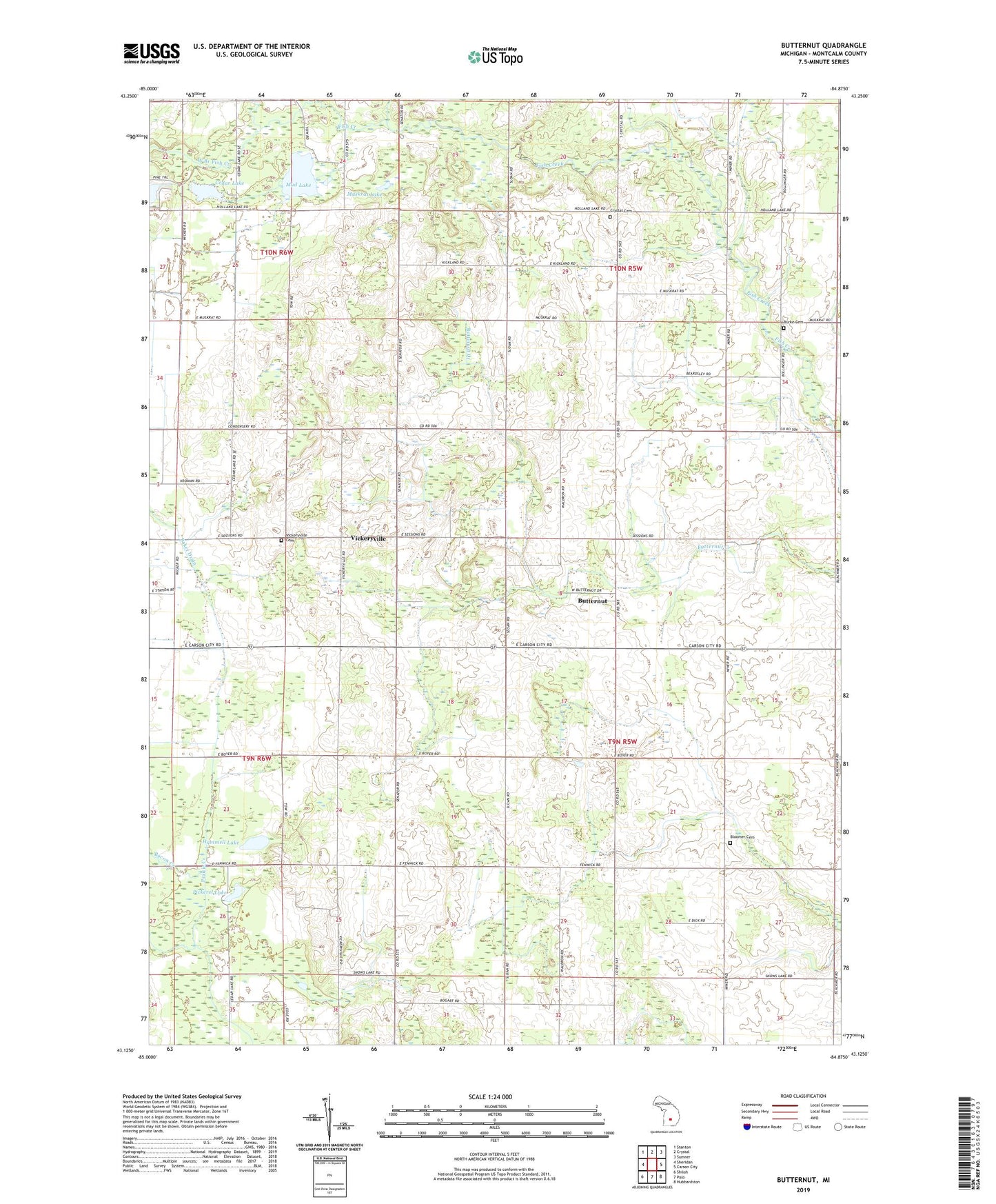
2019 topographic map quadrangle Butternut in the state of Michigan. Scale: 1:24000. Based on the newly updated USGS 7.5' US Topo map series, this map is in the following counties: Montcalm. The map contains contour data, water features, and other items you are used to seeing on USGS maps, but also has updated roads and other features. This is the next generation of topographic maps. Printed on high-quality waterproof paper with UV fade-resistant inks.
Quads adjacent to this one:
West: Sheridan
Northwest: Stanton
North: Crystal
Northeast: Sumner
East: Carson City
Southeast: Hubbardston
South: Palo
Southwest: Shiloh
Contains the following named places: Bacon Creek, Bloomer Cemetery, Bloomer Post Office, Burke Cemetery, Butternut, Butternut Post Office, Butternut Station, Cedar Lake, Church of Brethren, Crystal Cemetery, Hammell Lake, Mayes Airport, Mud Lake, Mud Lake Church, Muskrat Lake, Oaklawn Church, Pickerel Lake, Township of Bloomer, Township of Crystal, Vickeryville, Vickeryville Cemetery, Vickeryville Post Office, Vickeryville Station, West Branch Fish Creek