MyTopo
Palo Michigan US Topo Map
Couldn't load pickup availability
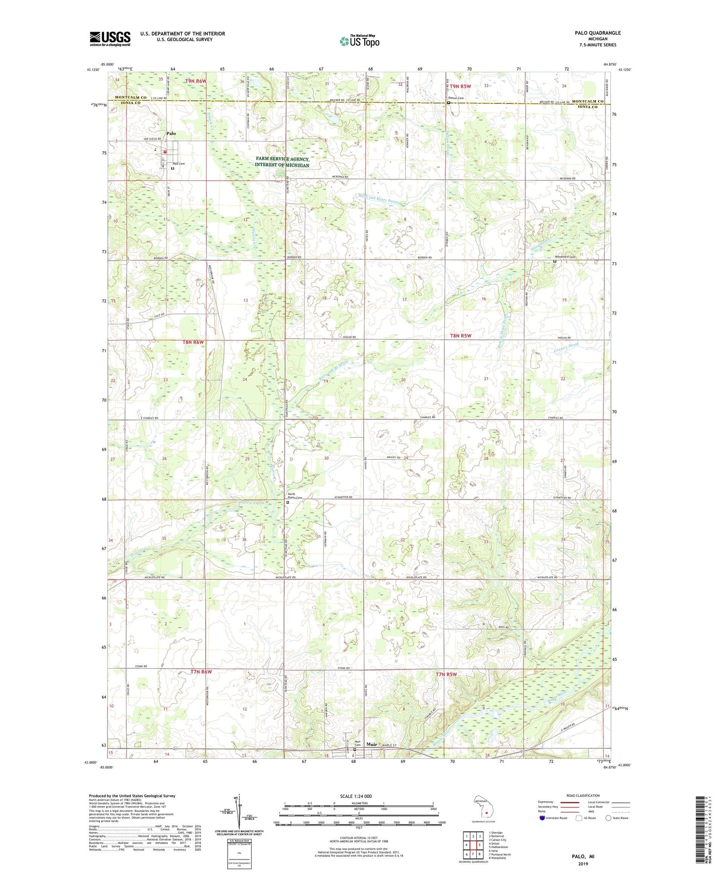
2023 topographic map quadrangle Palo in the state of Michigan. Scale: 1:24000. Based on the newly updated USGS 7.5' US Topo map series, this map is in the following counties: Ionia, Montcalm. The map contains contour data, water features, and other items you are used to seeing on USGS maps, but also has updated roads and other features. This is the next generation of topographic maps. Printed on high-quality waterproof paper with UV fade-resistant inks.
Quads adjacent to this one:
West: Shiloh
Northwest: Sheridan
North: Butternut
Northeast: Carson City
East: Hubbardston
Southeast: Westphalia
South: Portland North
Southwest: Ionia
This map covers the same area as the classic USGS quad with code o43084a8.
Contains the following named places: Bonnie Moor Drain, Dalton Cemetery, Dalton Drain, Hack and Keary Drain, Hayes School, Lee Spalding School, Lyons Muir Church, North Plains Cemetery, North Plains Post Office, Oakwood Cemetery, Palo, Palo Cemetery, Palo Census Designated Place, Palo Post Office, Pine Haven Estates Mobile Home Park, Ronald Township Volunteer Fire Department, Ross and Branch Drain, Schaeffer School, Stony Creek, Township of North Plains, Twin Rivers Elementary School, Union Church, Woodward Cemetery, ZIP Codes: 48860, 48870