MyTopo
Caseville Michigan US Topo Map
Couldn't load pickup availability
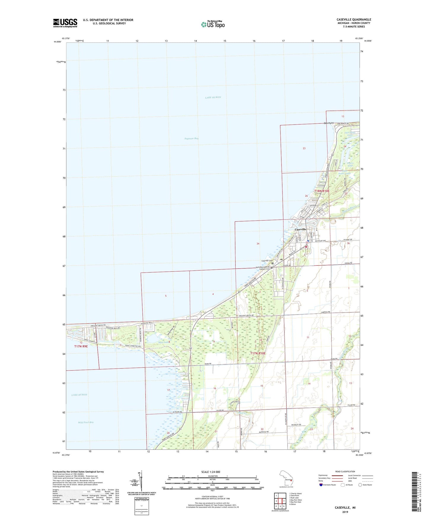
2023 topographic map quadrangle Caseville in the state of Michigan. Scale: 1:24000. Based on the newly updated USGS 7.5' US Topo map series, this map is in the following counties: Huron. The map contains contour data, water features, and other items you are used to seeing on USGS maps, but also has updated roads and other features. This is the next generation of topographic maps. Printed on high-quality waterproof paper with UV fade-resistant inks.
Quads adjacent to this one:
West: Sand Point
Northwest: Charity Island
East: Rush Lake
Southeast: Elkton
South: Bay Port East
Southwest: Bay Port West
This map covers the same area as the classic USGS quad with code o43083h3.
Contains the following named places: Beadle Marina, Calvary Baptist Church, Campau Drain, Caseville, Caseville County Park, Caseville Family Medicine Clinic, Caseville Fire Department, Caseville High School, Caseville Municipal Harbor, Caseville Police Department, Caseville Post Office, Caseville Station, Caseville Township Cemetery, Caseville Township Hall, Caseville United Methodist Church, City of Caseville, Doerr Lake, Farver Field, Good Shepherd Lutheran Church, Hamricks Resort, Hayes Church, Hayes Post Office, Hidden Harbour Golf Course, Huron County Park, Huron Yacht Club, Lakeside Marina, Little Doerr Lake, McKinley Drain, Methodist Episcopal Church Historical Marker, Mud Creek, Mud Lake, Newman Drain, Oak Point, Oak Point Lake, Pigeon River, Saginaw Bay Marina, Saint Johns Church, Saint Roch Cemetery, Saint Roch Church, Scenic Golf and Country Club, Thiel Farms, Township of Caseville, Wild Fowl Bay