MyTopo
Elkton Michigan US Topo Map
Couldn't load pickup availability
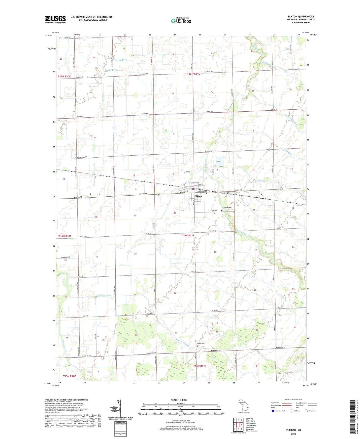
2023 topographic map quadrangle Elkton in the state of Michigan. Scale: 1:24000. Based on the newly updated USGS 7.5' US Topo map series, this map is in the following counties: Huron. The map contains contour data, water features, and other items you are used to seeing on USGS maps, but also has updated roads and other features. This is the next generation of topographic maps. Printed on high-quality waterproof paper with UV fade-resistant inks.
Quads adjacent to this one:
West: Bay Port East
Northwest: Caseville
North: Rush Lake
Northeast: Kinde West
East: Bad Axe West
Southeast: New Greenleaf
South: Gagetown
Southwest: Owendale
This map covers the same area as the classic USGS quad with code o43083g2.
Contains the following named places: Beaubien Drain, Bechler Drain, Century Oaks Golf Course, Elkton, Elkton Church, Elkton Drain, Elkton Fair Drain, Elkton Family Medicine Clinic, Elkton Police Department, Elkton Post Office, Elkton Station, Elkton United Methodist Church, Fluegge Drain, Fritz Farms, Grant Cemetery, Hill Drain, Kasserman Farms, Laker Elementary School, Laker High School, Nettle Run, Oliver Drain, Oliver Township Fire Department, Renn Farms, Riverside Cemetery, Schuette Dairy Farm, Schultz Drain, Silver Creek, Squarno Drain, Township of Oliver, Trinity Evangelical Lutheran Church, Village of Elkton, Wesleyan Church, Whipple Tree Farm, Wolfton Post Office, ZIP Codes: 48731, 48755