MyTopo
Chesaning East Michigan US Topo Map
Couldn't load pickup availability
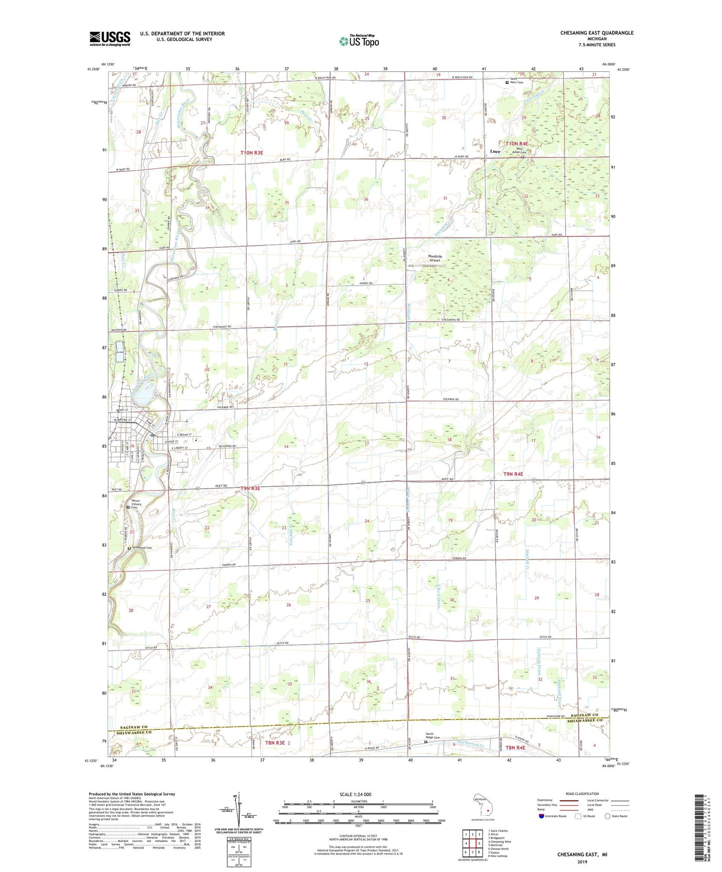
2019 topographic map quadrangle Chesaning East in the state of Michigan. Scale: 1:24000. Based on the newly updated USGS 7.5' US Topo map series, this map is in the following counties: Saginaw, Shiawassee. The map contains contour data, water features, and other items you are used to seeing on USGS maps, but also has updated roads and other features. This is the next generation of topographic maps. Printed on high-quality waterproof paper with UV fade-resistant inks.
Quads adjacent to this one:
West: Chesaning West
Northwest: Saint Charles
North: Alicia
Northeast: Bridgeport
East: Montrose
Southeast: New Lothrop
South: Easton
Southwest: Owosso North
Contains the following named places: Adams Drain, Albert Drain, Big Rock Elementary School, Chesaning, Chesaning Area Historical Museum, Chesaning Church of Christ, Chesaning Family Medicine, Chesaning Nursing Care Center, Chesaning Police Department, Chesaning Post Office, Chesaning Public Library, Chesaning Station, Church of the Nazarene, Cole Park, George Nason House Historical Marker, Leamington Stewart House Historical Marker, Luce, Luce Post Office, Maple Grove Airpark, Mobile Medical Response Chesaning, Mount Calvary Cemetery, New Wine Full Gospel Church, North Ridge Cemetery, Orser Drain, Our Lady of Perpetual Help Church, Our Lady of Perpetual Help School, Richter Drain, Saint Mary Cemetery, Saint Mary's Clinic, Seventh Day Adventist Church, Showboat Park, Township of Chesaning, Village Baptist Church, Village of Chesaning, WAQP-TV (Saginaw), West Albee Cemetery, Wickham Drain, WJRT-TV (Flint), Woodside Airport, WSMH-TV (Flint), Zion Evangelical School, ZIP Code: 48616