MyTopo
Chesaning West Michigan US Topo Map
Couldn't load pickup availability
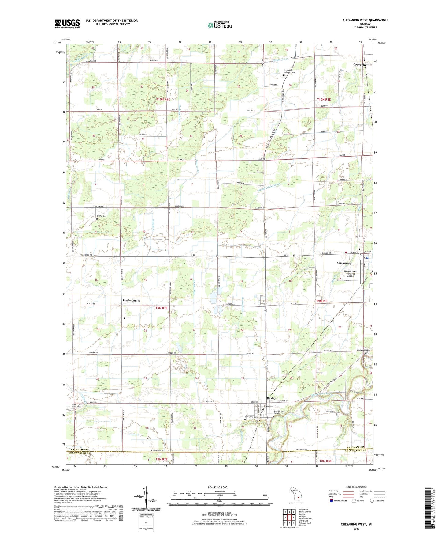
2019 topographic map quadrangle Chesaning West in the state of Michigan. Scale: 1:24000. Based on the newly updated USGS 7.5' US Topo map series, this map is in the following counties: Saginaw, Shiawassee. The map contains contour data, water features, and other items you are used to seeing on USGS maps, but also has updated roads and other features. This is the next generation of topographic maps. Printed on high-quality waterproof paper with UV fade-resistant inks.
Quads adjacent to this one:
West: Chapin
Northwest: Lakefield
North: Saint Charles
Northeast: Alicia
East: Chesaning East
Southeast: Easton
South: Owosso North
Southwest: Ovid East
Contains the following named places: Brady Center, Brady Center Wesleyan Church, Brady Elementary School, Brady Post Office, Brown Fickies Drain, Chesaning Brady Fire Department Station 1, Chesaning Middle School, Chesaning Union High School, Christ Church, Dygert Drain, Francis Drain, Greens Drain, Griffus Cemetery, Groveton, Howard Nixon Memorial Airport, Kingdom Hall, Leutz Post Office, Mickles Creek, Oak Grove Cemetery, Oakley, Oakley Community Church, Oakley Post Office, Oakley Station, Oakley Village Hall, Parshallburg, Pine Grove County Park, Ridge Road Cemetery, Saginaw County Fairgrounds, Saint John's Lutheran Cemetery, Saint Michael Church, Saint Michael's Catholic Cemetery, Stoddard Mobile Court, Township of Brady, Trinity United Methodist Church, Twin Brook Golf Course, Village of Oakley, Wildwood Cemetery, ZIP Code: 48649