MyTopo
Chapin Michigan US Topo Map
Couldn't load pickup availability
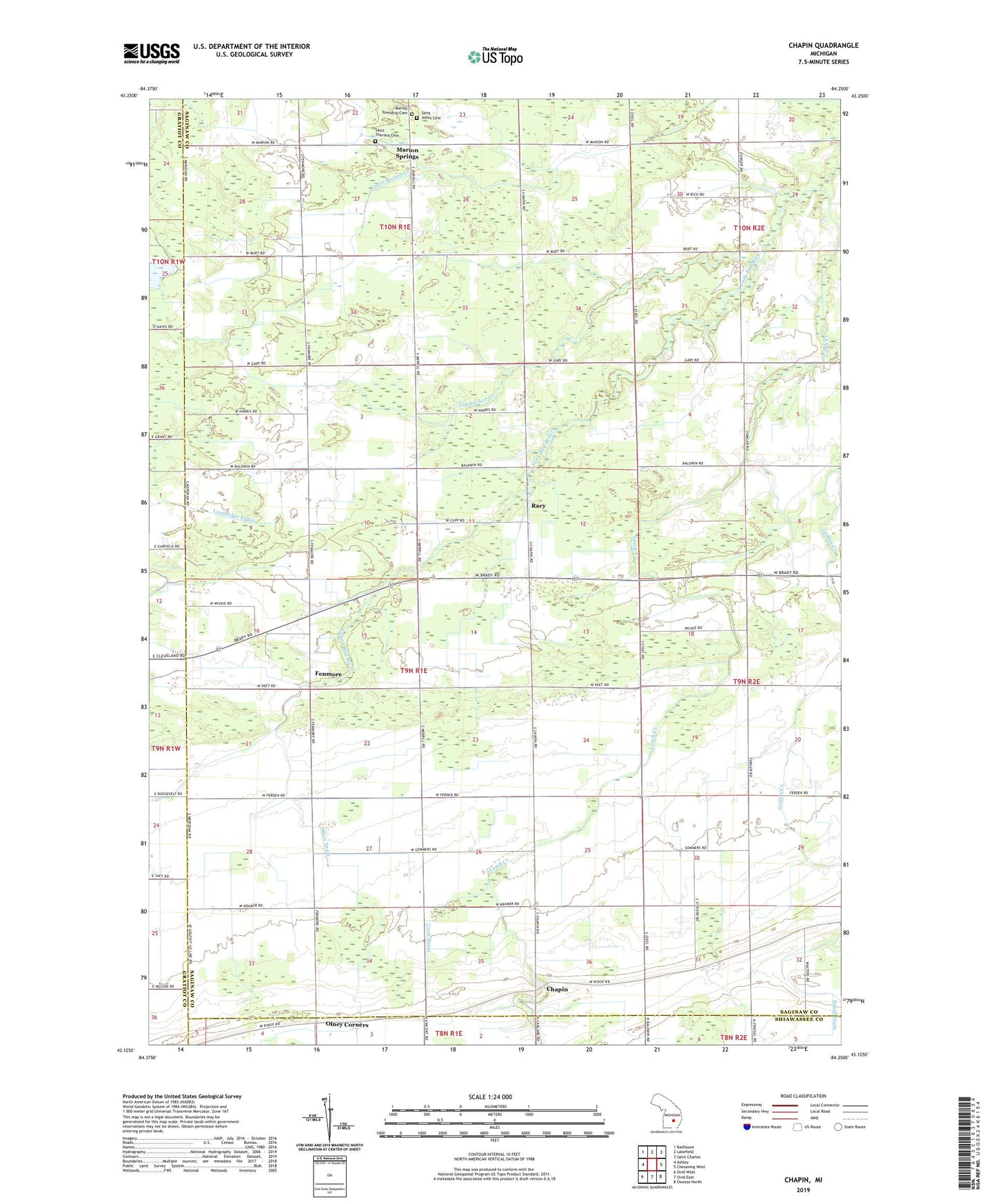
2023 topographic map quadrangle Chapin in the state of Michigan. Scale: 1:24000. Based on the newly updated USGS 7.5' US Topo map series, this map is in the following counties: Saginaw, Gratiot, Shiawassee. The map contains contour data, water features, and other items you are used to seeing on USGS maps, but also has updated roads and other features. This is the next generation of topographic maps. Printed on high-quality waterproof paper with UV fade-resistant inks.
Quads adjacent to this one:
West: Ashley
Northwest: Rathbone
North: Lakefield
Northeast: Saint Charles
East: Chesaning West
Southeast: Owosso North
South: Ovid East
Southwest: Ovid West
This map covers the same area as the classic USGS quad with code o43084b3.
Contains the following named places: Amman Farm, Bibrietz Drain, Chapin, Chapin Post Office, Chapin United Methodist Church, Coon Drain, Fenmore, Fenmore Post Office, Gratiot - Saginaw State Game Management Area, Griffus Creek, Lamb Creek, Limbocker Creek, Limbocker Drain, Marion Springs, Marion Springs Post Office, Marion Township Cemetery, North Branch Limbocker Drain, Olney Corners, Olney Drain, Racy, Racy Church, Racy Post Office, Saint Johns Cemetery, Saint John's Lutheran Church, Saint Johns School, Saint Theresa Cemetery, Township of Chapin