
MyTopo
Colling Michigan US Topo Map
Couldn't load pickup availability
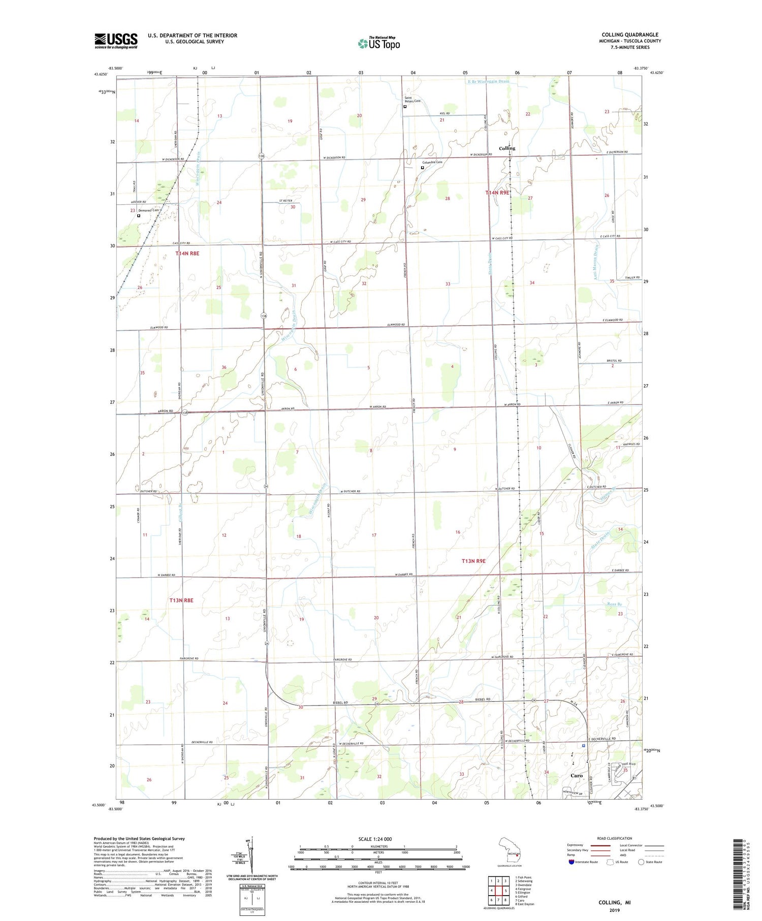
2019 topographic map quadrangle Colling in the state of Michigan. Scale: 1:24000. Based on the newly updated USGS 7.5' US Topo map series, this map is in the following counties: Tuscola. The map contains contour data, water features, and other items you are used to seeing on USGS maps, but also has updated roads and other features. This is the next generation of topographic maps. Printed on high-quality waterproof paper with UV fade-resistant inks.
Quads adjacent to this one:
West: Fairgrove
Northwest: Fish Point
North: Sebewaing
Northeast: Owendale
East: Ellington
Southeast: East Dayton
South: Caro
Southwest: Gilford
Contains the following named places: Alex Drain, Almer Center School, Almer Township Hall, Anti Mason Drain, Bach Drain, Bethel Church, Bills Rohlfs Drain, Caro Area Health Clinic, Colling, Colling Nazarene Church, Colling Post Office, Colling Station, Columbia Cemetery, Columbia Corners, Columbia Post Office, Cutler Drain, Davenport University, Demorest Cemetery, Fairgrove Church, Free Methodist Church, Gilbert Branch, Great Lakes Baptist Church, Highland Pines School, Hoover Drain, Humes Branch, Jordon Drain, Lewis School, Lighthouse Baptist Church, Michigan State Police District 3 Caro Post 33, Parsell School, Pike Drain, Prin Drain, Providence Church, Romain Drain, Ross Branch, Saint Peters Cemetery, Saint Peters Church, Streeter Drain, Sugartree Mobile Home Park, Township of Almer


