MyTopo
Gilford Michigan US Topo Map
Couldn't load pickup availability
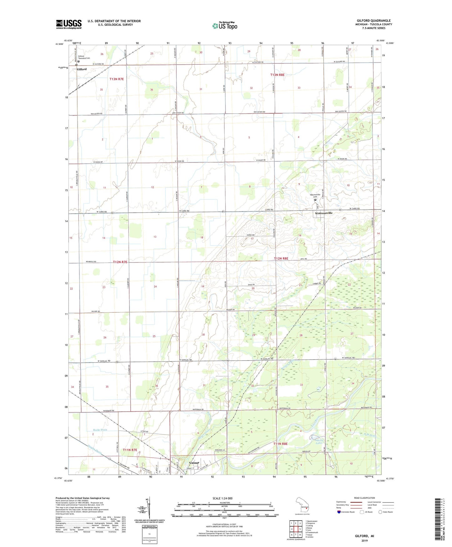
2023 topographic map quadrangle Gilford in the state of Michigan. Scale: 1:24000. Based on the newly updated USGS 7.5' US Topo map series, this map is in the following counties: Tuscola. The map contains contour data, water features, and other items you are used to seeing on USGS maps, but also has updated roads and other features. This is the next generation of topographic maps. Printed on high-quality waterproof paper with UV fade-resistant inks.
Quads adjacent to this one:
West: Reese
Northwest: Quanicassee
North: Fairgrove
Northeast: Colling
East: Caro
Southeast: Juniata
South: Vassar
Southwest: Frankenmuth
This map covers the same area as the classic USGS quad with code o43083d5.
Contains the following named places: Brewer Drain, Crossman Post Office, Denmark Post Office, E-M Drain, Enos Drain, Foess Drain, Garner Drain, Gilford, Gilford Post Office, Gilford Station, Gilford Township Cemetery, Gilford United Methodist Church Historical Marker, Haines Drain, H-M Drain, Hobart School, Humes Drain, Juniata Township Cemetery, Juniata Township Hall, Karrs Corner, Martin Drain, Northwest Drain, Odessa Lakes, Saint Frances X Cabrini Church, Saint Lukes Lutheran School, Saint Marys Vassar Health Clinic, Tappan School, Township of Juniata, Trombka Drain, Vassar Church, Vassar Golf and Country Club, Vassar High School, Vassar State Game Area, Watrous General Store Historical Marker, Watrousville, Watrousville Post Office, Watrousville United Methodist Church, Watrousville United Methodist Church Historical Marker, Wilson Drain