MyTopo
Fish Point Michigan US Topo Map
Couldn't load pickup availability
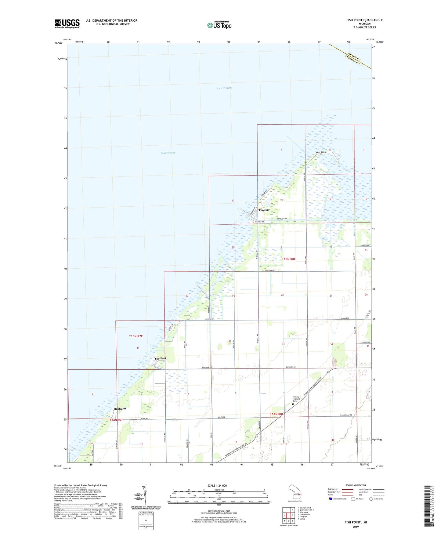
2023 topographic map quadrangle Fish Point in the state of Michigan. Scale: 1:24000. Based on the newly updated USGS 7.5' US Topo map series, this map is in the following counties: Tuscola, Huron. The map contains contour data, water features, and other items you are used to seeing on USGS maps, but also has updated roads and other features. This is the next generation of topographic maps. Printed on high-quality waterproof paper with UV fade-resistant inks.
Quads adjacent to this one:
West: Quanicassee OE N
Northeast: Bay Port West
East: Sebewaing
Southeast: Colling
South: Fairgrove
Southwest: Quanicassee
This map covers the same area as the classic USGS quad with code o43083f5.
Contains the following named places: Ackerman Drain, Bay Park, Fish Point, Hickory Highland Cemetery, Oakhurst, Oakhurst Park Marina Association, Sunset Bay Marina Incorporated, Thomas, Thomas Marina, Township of Akron, Wiscoggin Drain