MyTopo
Deadmans Hill Michigan US Topo Map
Couldn't load pickup availability
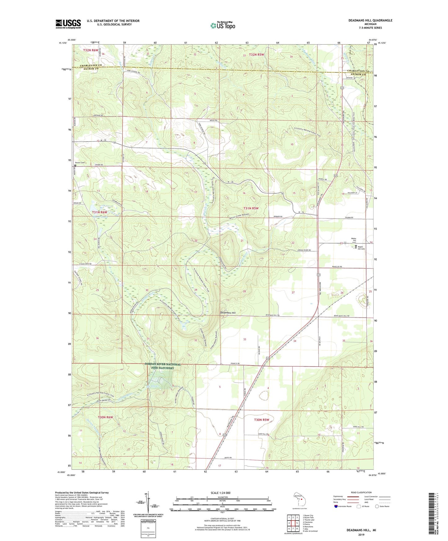
2023 topographic map quadrangle Deadmans Hill in the state of Michigan. Scale: 1:24000. Based on the newly updated USGS 7.5' US Topo map series, this map is in the following counties: Antrim, Charlevoix. The map contains contour data, water features, and other items you are used to seeing on USGS maps, but also has updated roads and other features. This is the next generation of topographic maps. Printed on high-quality waterproof paper with UV fade-resistant inks.
Quads adjacent to this one:
West: Chestonia
Northwest: Boyne City
North: Boyne Falls
Northeast: Thumb Lake
East: Elmira
Southeast: Lake Arrowhead
South: Alba
Southwest: Mancelona
This map covers the same area as the classic USGS quad with code o45084a8.
Contains the following named places: Brown Cemetery, Deadmans Hill, Jordan Lookout Tower, Jordan River National Fish Hatchery, Maple Hill Cemetery, Marsh Ponds, O'Brien Pond, Section Thirteen Creek, Simons Post Office, Simons Station, Six Tile Creek, Township of Warner