MyTopo
Chestonia Michigan US Topo Map
Couldn't load pickup availability
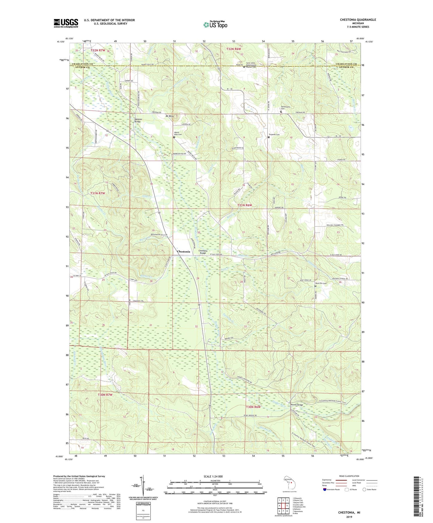
2023 topographic map quadrangle Chestonia in the state of Michigan. Scale: 1:24000. Based on the newly updated USGS 7.5' US Topo map series, this map is in the following counties: Antrim, Charlevoix. The map contains contour data, water features, and other items you are used to seeing on USGS maps, but also has updated roads and other features. This is the next generation of topographic maps. Printed on high-quality waterproof paper with UV fade-resistant inks.
Quads adjacent to this one:
West: Scotts Lake
Northwest: Ellsworth
North: Boyne City
Northeast: Boyne Falls
East: Deadmans Hill
Southeast: Alba
South: Mancelona
Southwest: Bellaire
This map covers the same area as the classic USGS quad with code o45085a1.
Contains the following named places: Bartholomew Creek, Bennett Creek, Cascade Creek, Chestonia, Chestonia Bridge, Chestonia Post Office, Chestonia Station, Chestonia Township Number One Cemetery, Finkton, Finkton Post Office, Gook Creek, Grace Church, Graves Crossing, Graves Crossing State Forest Campground, Green River, Green River Ranch, Hitchcock Creek, Hitchcock Station, Kocher Creek, Landslide Creek, Lilak Creek, Martin Creek, Mill Creek, Mount Bliss, Mount Bliss Cemetery, Pinney Bridge, Pinney Bridge State Forest Campground, Rock Elm Cemetery, Rockery Post Office, Saint John Nepomucene Catholic Church Historical Marker, Saint Johns Church, Saint Johns Nepomucene Pioneer Cemetery, Scott Creek, Settlement Cemetery, Severance Creek, Stevens Creek, Sutton Creek, Todd Creek, Township of Jordan, Trojanek Cemetery, Tutstone Creek, Webster Bridge, Webster Creek