MyTopo
Delaware Michigan US Topo Map
Couldn't load pickup availability
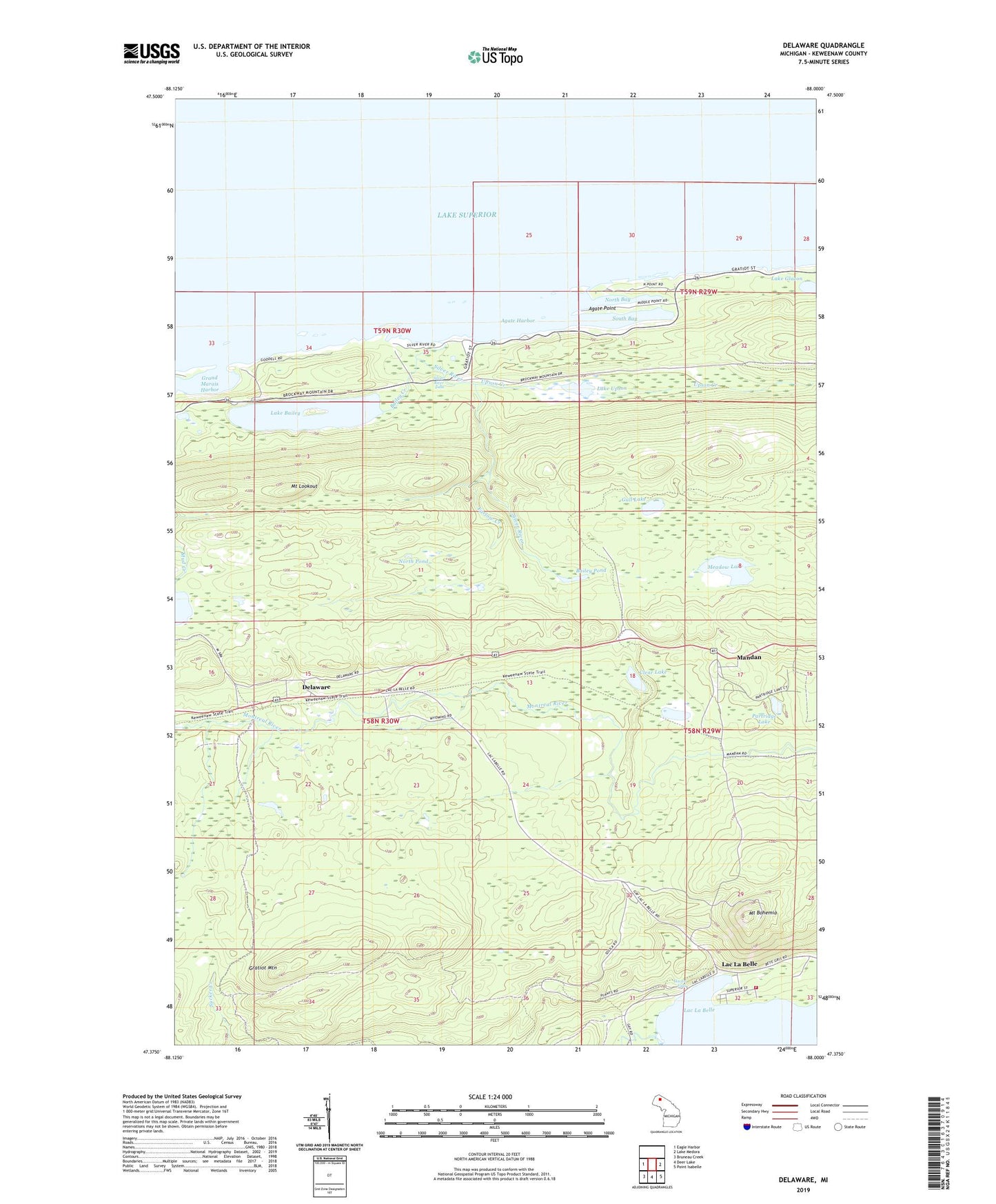
2019 topographic map quadrangle Delaware in the state of Michigan. Scale: 1:24000. Based on the newly updated USGS 7.5' US Topo map series, this map is in the following counties: Keweenaw. The map contains contour data, water features, and other items you are used to seeing on USGS maps, but also has updated roads and other features. This is the next generation of topographic maps. Printed on high-quality waterproof paper with UV fade-resistant inks.
Quads adjacent to this one:
West: Eagle Harbor
East: Lake Medora
Southeast: Point Isabelle
South: Deer Lake
Southwest: Bruneau Creek
Contains the following named places: Agate Harbor, Agate Point, Bailey Creek, Bailey Pond, Clear Lake, Delaware, Esrey Park, Farlow Creek, Grand Marais Harbor, Gratiot Mountain, Gull Lake, Haven Creek, Haven Falls, Haven Park, Lac La Belle, Lac La Belle Fire Department, Lac La Belle Marina, Lac La Belle Resort, Lake Bailey, Lake Upson, Little Gratiot River, Mandan, Mandan Post Office, Mandan Station, Meadow Lake, Mount Bohemia, Mount Bohemia Ski Area, Mount Lookout, Mud Lake, North Bay, North Pond, Partridge Lake, Silver River, Silver River Falls, South Bay, Upson Creek, Wyoming