MyTopo
Lake Medora Michigan US Topo Map
Couldn't load pickup availability
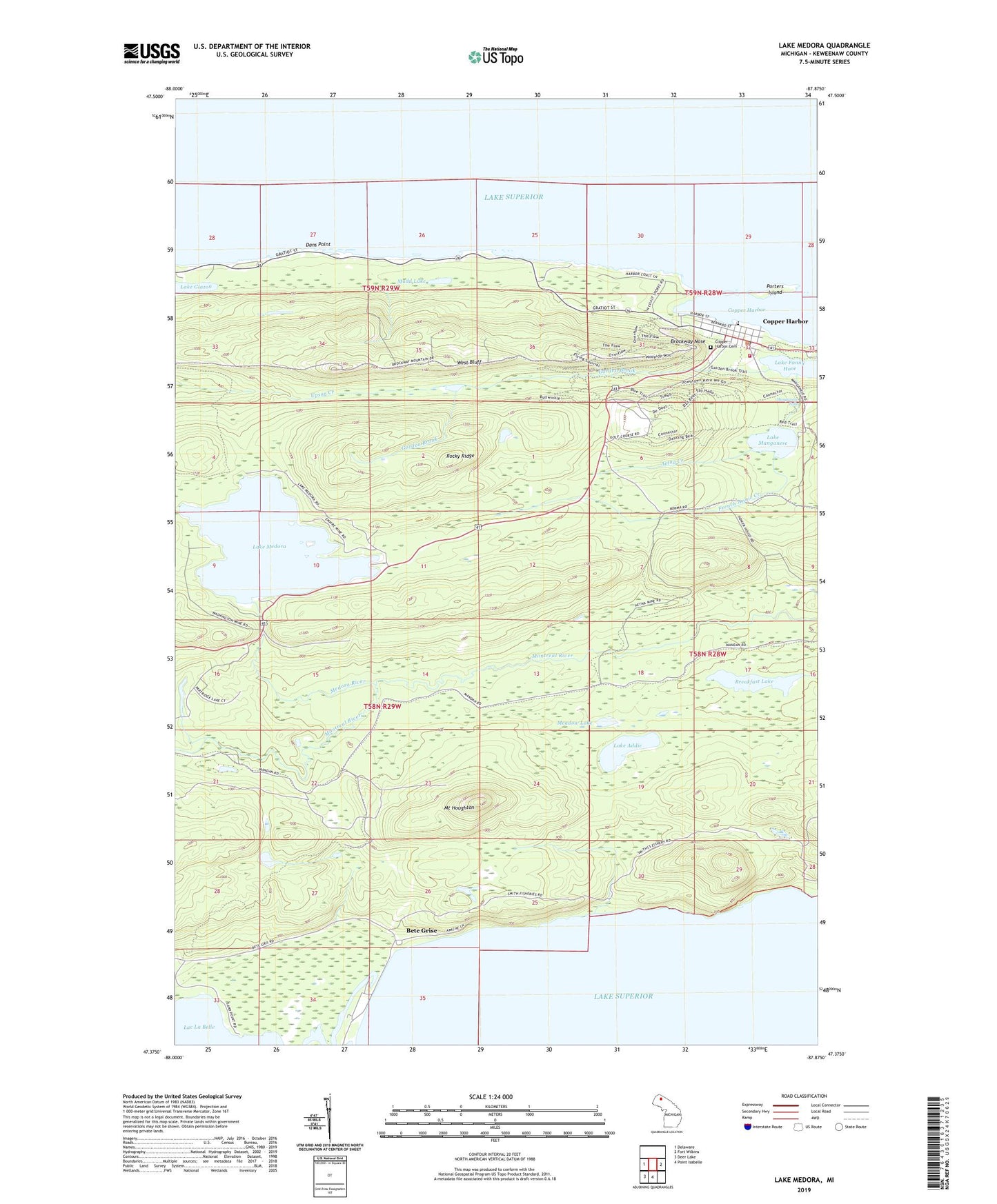
2023 topographic map quadrangle Lake Medora in the state of Michigan. Scale: 1:24000. Based on the newly updated USGS 7.5' US Topo map series, this map is in the following counties: Keweenaw. The map contains contour data, water features, and other items you are used to seeing on USGS maps, but also has updated roads and other features. This is the next generation of topographic maps. Printed on high-quality waterproof paper with UV fade-resistant inks.
Quads adjacent to this one:
West: Delaware
East: Fort Wilkins
South: Point Isabelle
Southwest: Deer Lake
This map covers the same area as the classic USGS quad with code o47087d8.
Contains the following named places: Aetna Creek, Bete Grise, Breakfast Lake, Brockway Nose, Copper Harbor, Copper Harbor Cemetery, Copper Harbor Census Designated Place, Copper Harbor Fire Department, Copper Harbor Marine, Copper Harbor Post Office, Copper Harbor School, Dans Point, French Annie Creek, Garden Brook, Grant Township Town Hall, Hebard Park, Keweenaw County Park, Keweenaw Mountain Lodge Golf Course, Lake Addie, Lake Fanny Hooe Resort and Campground, Lake Glazon, Lake Manganese, Lake Medora, Manganese Falls, Meadow Lake, Medora River, Mount Houghton, Mudd Lake, North Piech Lighthouse, Porters Island, Rocky Ridge, Township of Grant, West Bluff