MyTopo
Duck Lake Michigan US Topo Map
Couldn't load pickup availability
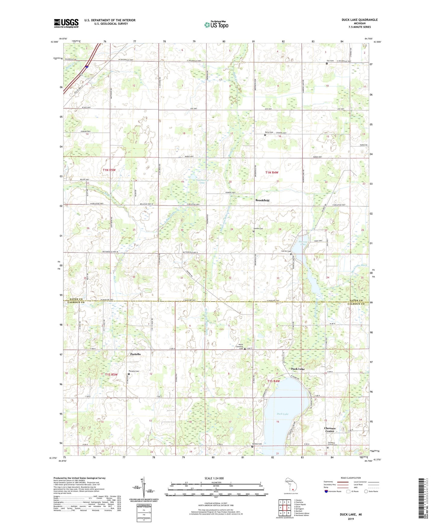
2019 topographic map quadrangle Duck Lake in the state of Michigan. Scale: 1:24000. Based on the newly updated USGS 7.5' US Topo map series, this map is in the following counties: Eaton, Calhoun. The map contains contour data, water features, and other items you are used to seeing on USGS maps, but also has updated roads and other features. This is the next generation of topographic maps. Printed on high-quality waterproof paper with UV fade-resistant inks.
Quads adjacent to this one:
West: Olivet
Northwest: Chester
North: Charlotte
Northeast: Eaton Rapids
East: Springport
Southeast: Northeast Albion
South: Northwest Albion
Southwest: Marshall
Contains the following named places: Albion Landing, Brookfield, Brookfield Post Office, Butterfield School, Canaans Hope Church, Carrier Cemetery, Charlotte Landing, Clarence Center, Clarence Center Cemetery, Clarence Post Office, Devil Lake Ditch, Duck Lake, Duck Lake Country Club, Duck Lake Ditch, Ducklake Post Office, East Page Ditch, Faith Academy, Faith Assembly of God Church, Fordham School, Fox Cemetery, Fox School, Full Gospel Church, Gildart School, Hockinberry School, Hogle and Miller Ditch, Hunt School, Mahan School, Mills Ditch, Mud Lake Ditch, Narrow Lake, Nichols Cemetery, Nichols School, North Clarence Cemetery, Partello, Partello Cemetery, Partello Post Office, Perry Cemetery, Perry School, Sherman School, Southward Lake, Sowles Cemetery, Striped School, Town Line Church, Township of Brookfield, Township of Clarence, Verplanck School, Walton School