MyTopo
Chester Michigan US Topo Map
Couldn't load pickup availability
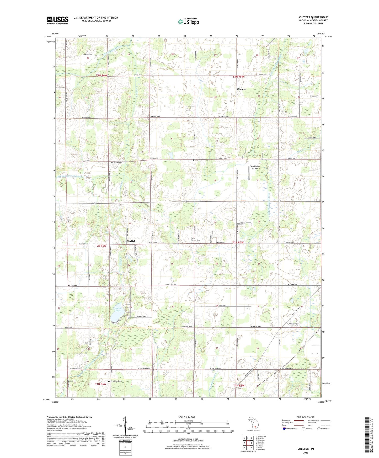
2023 topographic map quadrangle Chester in the state of Michigan. Scale: 1:24000. Based on the newly updated USGS 7.5' US Topo map series, this map is in the following counties: Eaton. The map contains contour data, water features, and other items you are used to seeing on USGS maps, but also has updated roads and other features. This is the next generation of topographic maps. Printed on high-quality waterproof paper with UV fade-resistant inks.
Quads adjacent to this one:
West: Nashville
Northwest: Saubee Lake
North: Hoytville
Northeast: Needmore
East: Charlotte
Southeast: Duck Lake
South: Olivet
Southwest: Bellevue
This map covers the same area as the classic USGS quad with code o42084e8.
Contains the following named places: Carlisle, Carlisle Post Office, Carlos Weber Roadside Park, Chester, Chester Post Office, Chester Station, Cogsdil Cemetery, Cogsdill School, Ells School, Fish Creek, Gayton and Powers Extension Drain, Hill Drain, Hubbard School, Lacey Creek, Lacey Lake, Lamie School, McLaughlin School, Millerburg School, Nye and Eaton Drainage, Pleasantview Elementary School, Powers Ditch, Spaulding Cemetery, Spaulding School, Swift School, Thornton School, Township of Carmel, Valley School, Wade School, Wells School, Wend Valley Airport, West Carmel Cemetery, West Carmel Church, Wyble School