MyTopo
Epoufette Michigan US Topo Map
Couldn't load pickup availability
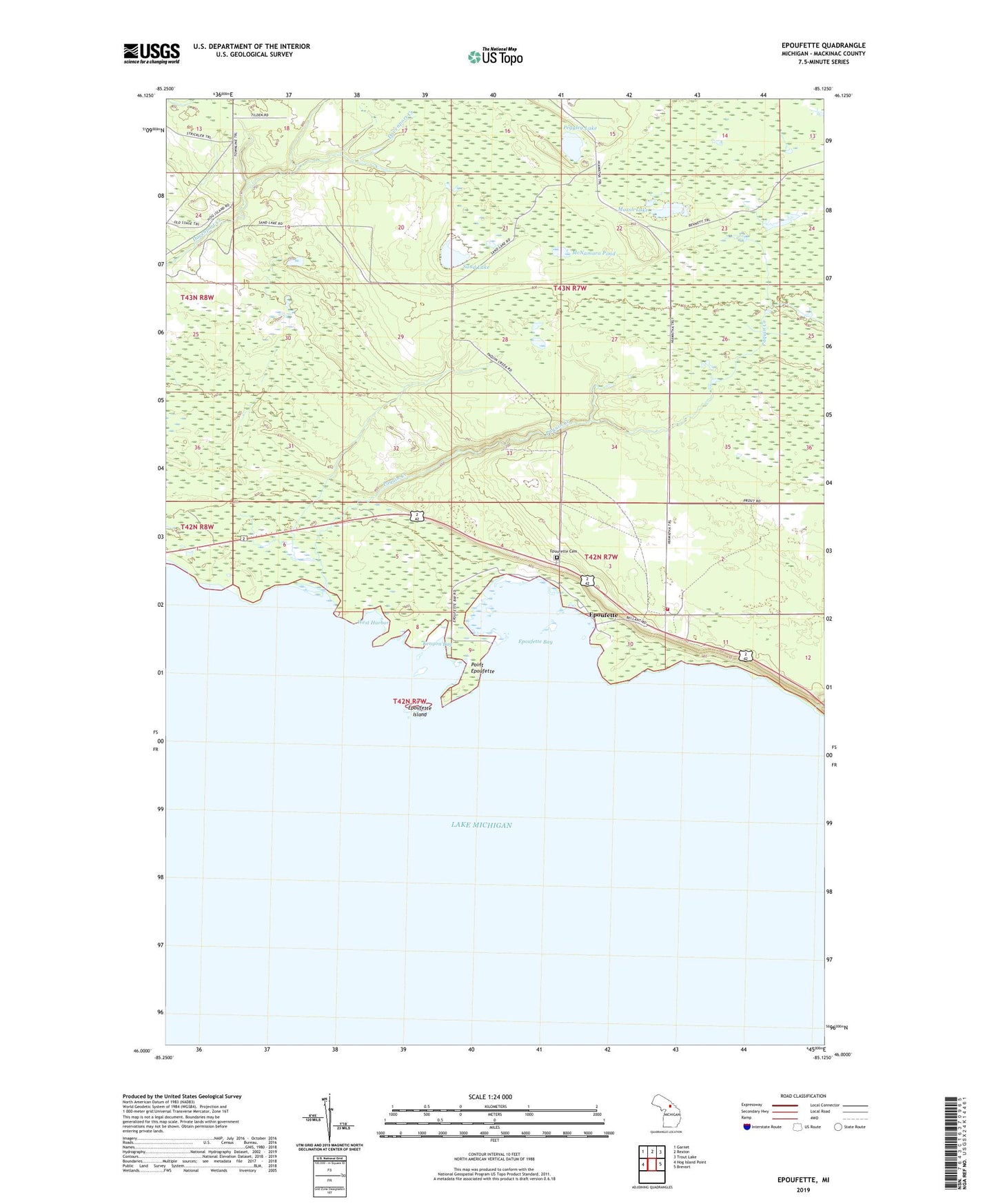
2023 topographic map quadrangle Epoufette in the state of Michigan. Scale: 1:24000. Based on the newly updated USGS 7.5' US Topo map series, this map is in the following counties: Mackinac. The map contains contour data, water features, and other items you are used to seeing on USGS maps, but also has updated roads and other features. This is the next generation of topographic maps. Printed on high-quality waterproof paper with UV fade-resistant inks.
Quads adjacent to this one:
West: Hog Island Point
Northwest: Garnet
North: Rexton
Northeast: Trout Lake
East: Brevort
This map covers the same area as the classic USGS quad with code o46085a2.
Contains the following named places: Cut River, Epoufette, Epoufette Bay, Epoufette Cemetery, Epoufette Historical Marker, Epoufette Island, Epoufette Post Office, Hendricks Township Volunteer Fire Department, Kenyon Bay, Marsh Lake, McNamara Pond, Paquin Creek, Peggley Lake, Pelkie Reef, Point Epoufette, Sand Lake, West Harbor