MyTopo
Foster City Michigan US Topo Map
Couldn't load pickup availability
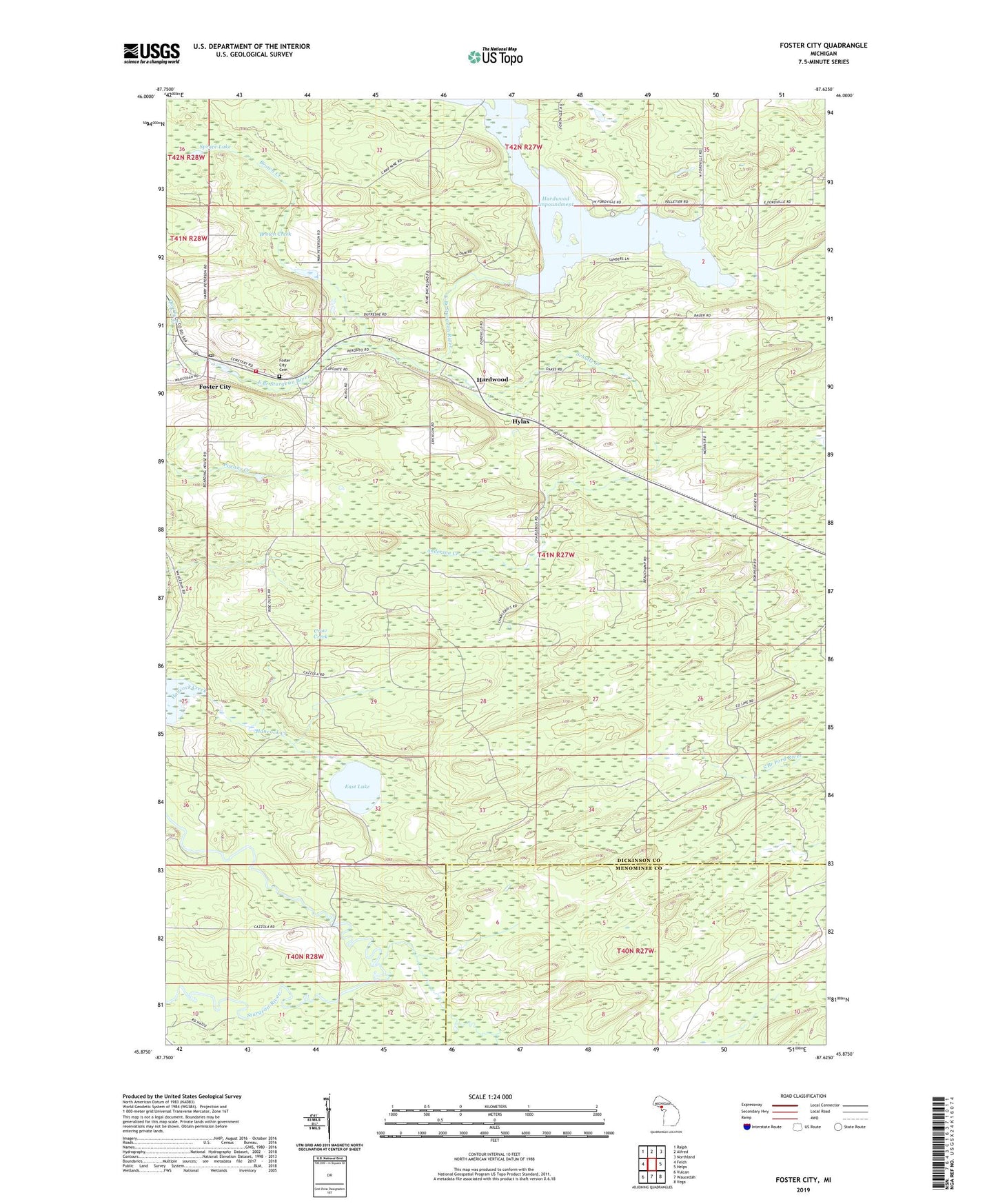
2023 topographic map quadrangle Foster City in the state of Michigan. Scale: 1:24000. Based on the newly updated USGS 7.5' US Topo map series, this map is in the following counties: Dickinson, Menominee. The map contains contour data, water features, and other items you are used to seeing on USGS maps, but also has updated roads and other features. This is the next generation of topographic maps. Printed on high-quality waterproof paper with UV fade-resistant inks.
Quads adjacent to this one:
West: Felch
Northwest: Ralph
North: Alfred
Northeast: Northland
East: Helps
Southeast: Vega
South: Waucedah
Southwest: Vulcan
This map covers the same area as the classic USGS quad with code o45087h6.
Contains the following named places: Anderson Creek, Breen Township Fire Department, Brown Creek, Crow Creek, East Lake, Foster City, Foster City Cemetery, Foster City Post Office, Foster City Station, Hardwood, Hardwood Impoundment, Hardwood Post Office, Hardwood Station, Hylas, Mission Covenant Church, Saint Joseph Catholic Church, Schultz Creek, Spruce Lake, Stromberg County Park, Township of Breen