MyTopo
Feldtmann Lake Michigan US Topo Map
Couldn't load pickup availability
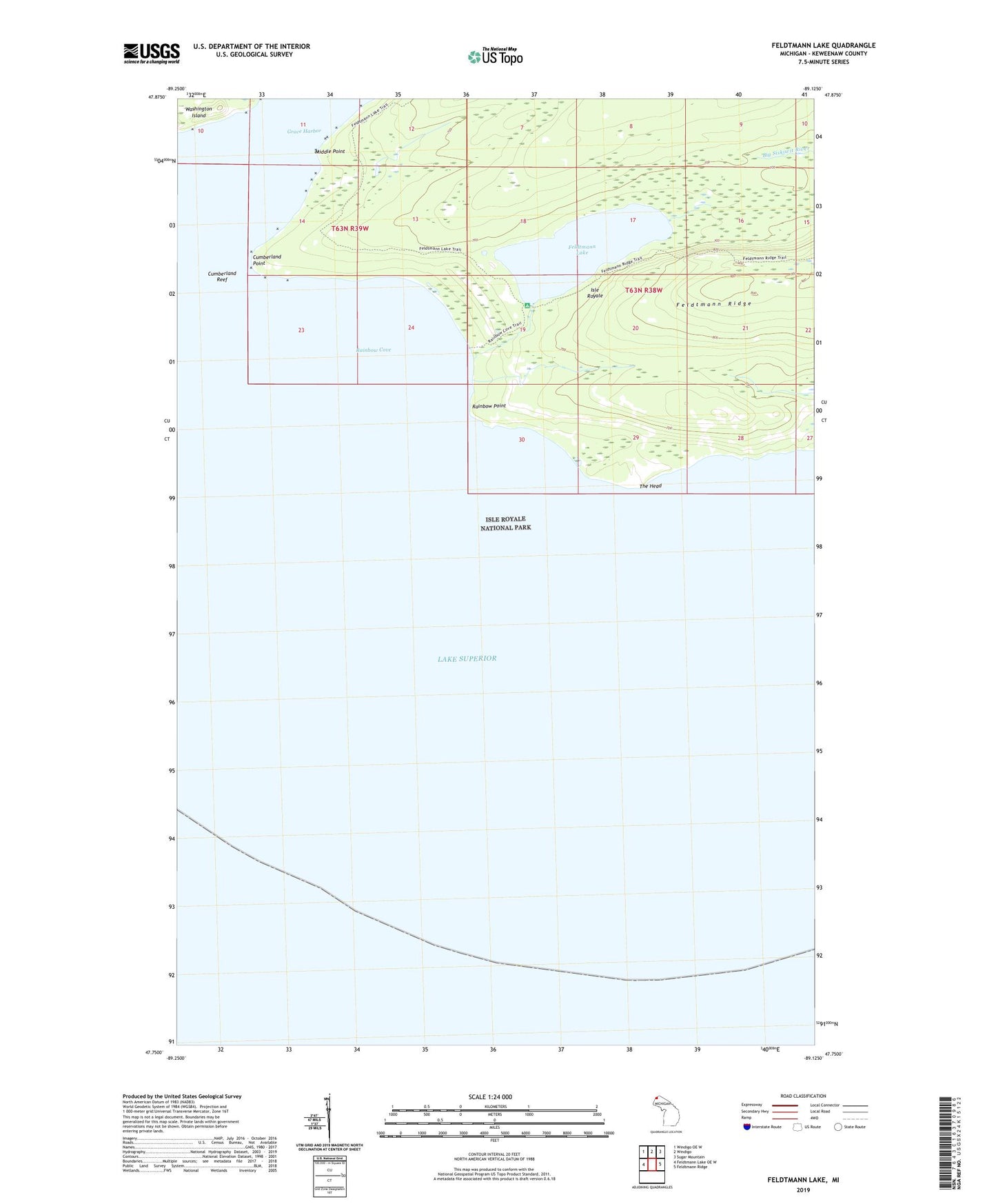
2023 topographic map quadrangle Feldtmann Lake in the state of Michigan. Scale: 1:24000. Based on the newly updated USGS 7.5' US Topo map series, this map is in the following counties: Keweenaw. The map contains contour data, water features, and other items you are used to seeing on USGS maps, but also has updated roads and other features. This is the next generation of topographic maps. Printed on high-quality waterproof paper with UV fade-resistant inks.
Quads adjacent to this one:
West: Feldtmann Lake OE W
Northwest: Windigo OE W
North: Windigo
Northeast: Sugar Mountain
East: Feldtmann Ridge
This map covers the same area as the classic USGS quad with code o47089g2.
Contains the following named places: Cumberland Point, Cumberland Reef, East Feldtmann Trail, Feldtmann Lake, Feldtmann Lake Campground, Feldtmann Ridge Trail, Grace Harbor, Johns Post Office, Middle Point, Rainbow Cove, Rainbow Cove Trail, Rainbow Point, The Head