MyTopo
Feldtmann Ridge Michigan US Topo Map
Couldn't load pickup availability
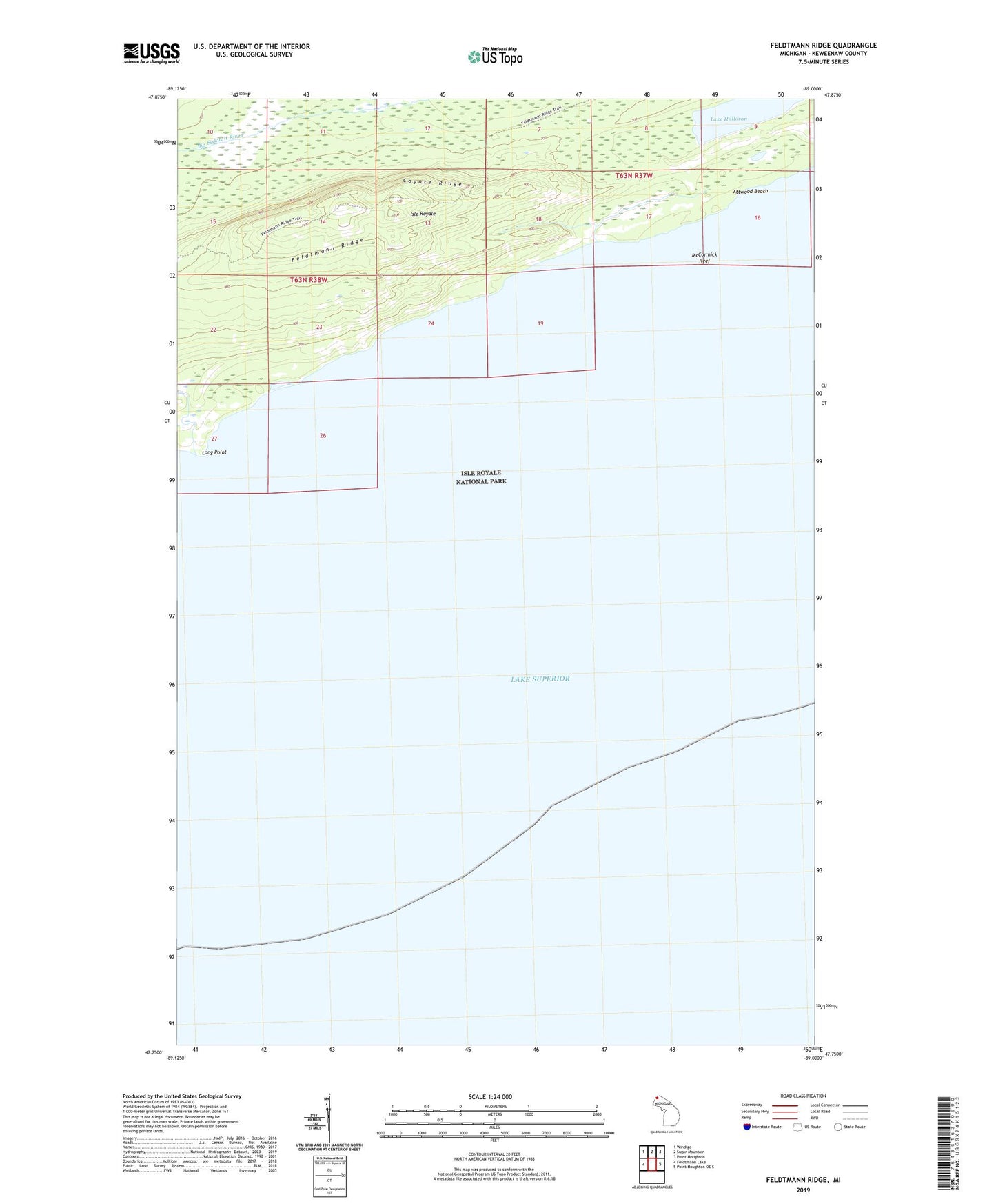
2023 topographic map quadrangle Feldtmann Ridge in the state of Michigan. Scale: 1:24000. Based on the newly updated USGS 7.5' US Topo map series, this map is in the following counties: Keweenaw. The map contains contour data, water features, and other items you are used to seeing on USGS maps, but also has updated roads and other features. This is the next generation of topographic maps. Printed on high-quality waterproof paper with UV fade-resistant inks.
Quads adjacent to this one:
West: Feldtmann Lake
Northwest: Windigo
North: Sugar Mountain
Northeast: Point Houghton
East: Point Houghton OE S
This map covers the same area as the classic USGS quad with code o47089g1.
Contains the following named places: Attwood Beach, Coyote Ridge, Feldtmann Lookout Tower, Feldtmann Ridge, Lake Halloran, Long Point, McCormick Reef