MyTopo
Foote Site Village Michigan US Topo Map
Couldn't load pickup availability
Also explore the Foote Site Village Forest Service Topo of this same quad for updated USFS data
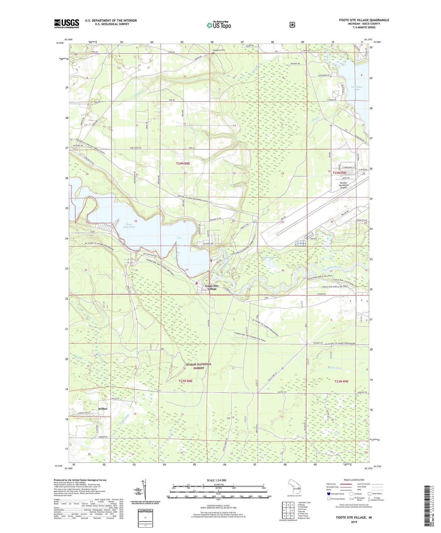
2023 topographic map quadrangle Foote Site Village in the state of Michigan. Scale: 1:24000. Based on the newly updated USGS 7.5' US Topo map series, this map is in the following counties: Iosco. The map contains contour data, water features, and other items you are used to seeing on USGS maps, but also has updated roads and other features. This is the next generation of topographic maps. Printed on high-quality waterproof paper with UV fade-resistant inks.
Quads adjacent to this one:
West: Sid Town
Northwest: Sprinkler Lake
North: Mikado
Northeast: Greenbush
East: Oscoda
Southeast: Spencer Lake
South: East Tawas
Southwest: Tawas City
This map covers the same area as the classic USGS quad with code o44083d4.
Contains the following named places: Allen Lake, Camp Nissokone, Chippewa Cemetery, Dry Creek, Foote Dam, Foote Dam Pond, Foote Site Village, Indian Creek, Loud Creek, Old Orchard Park, Old Orchard Park Campground, Oscoda Fire Department Station 2, Oscoda High School, Pine River, Richardson School, River Road School, Sevenmile Hill Lookout Tower, State Ditch, Wilber, Wilber Post Office, Wurtsmith Air Force Base, ZIP Code: 48750