MyTopo
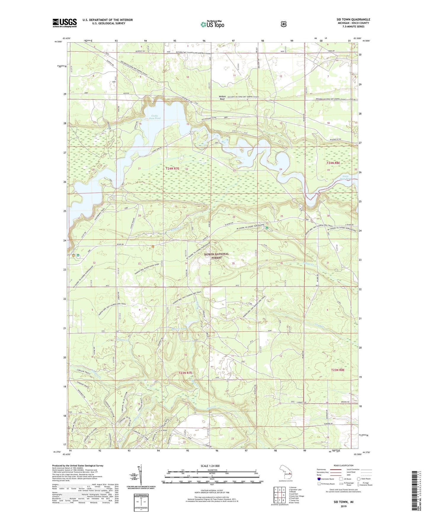
Sid Town Michigan US Topo Map
Couldn't load pickup availability
Also explore the Sid Town Forest Service Topo of this same quad for updated USFS data
2023 topographic map quadrangle Sid Town in the state of Michigan. Scale: 1:24000. Based on the newly updated USGS 7.5' US Topo map series, this map is in the following counties: Iosco. The map contains contour data, water features, and other items you are used to seeing on USGS maps, but also has updated roads and other features. This is the next generation of topographic maps. Printed on high-quality waterproof paper with UV fade-resistant inks.
Quads adjacent to this one:
West: Loud Dam
Northwest: Glennie
North: Sprinkler Lake
Northeast: Mikado
East: Foote Site Village
Southeast: East Tawas
South: Tawas City
Southwest: Floyd Lake
This map covers the same area as the classic USGS quad with code o44083d5.
Contains the following named places: Buck Creek, Buck Creek Pond, Charter Township of Oscoda, Cooke Dam, Cooke Hydroelectric Plant Historical Marker, Gordon Creek, Lumbermens Monument Visitor Center, Monument Campground, Sid Town, Silver Creek Lookout Tower, Silver Valley Campground, Stanton Creek, Township of Wilber, Wilber Church, Wildcat Creek, WKJC-FM (Tawas City), Wrights Lake, Yankee Reef