MyTopo
Freedom Michigan US Topo Map
Couldn't load pickup availability
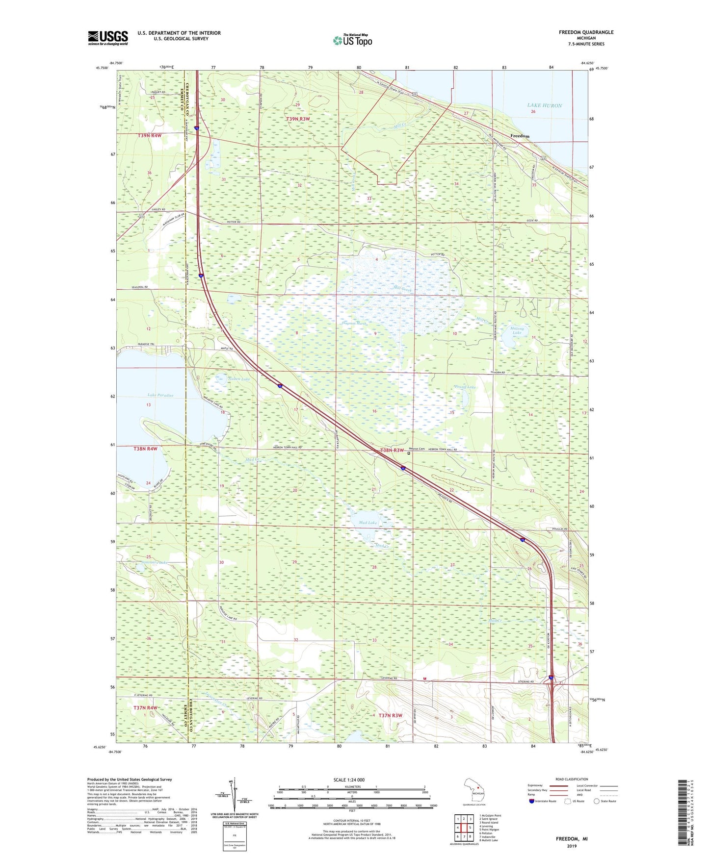
2019 topographic map quadrangle Freedom in the state of Michigan. Scale: 1:24000. Based on the newly updated USGS 7.5' US Topo map series, this map is in the following counties: Cheboygan, Emmet. The map contains contour data, water features, and other items you are used to seeing on USGS maps, but also has updated roads and other features. This is the next generation of topographic maps. Printed on high-quality waterproof paper with UV fade-resistant inks.
Quads adjacent to this one:
West: Levering
Northwest: McGulpin Point
North: Saint Ignace
Northeast: Round Island
East: Point Nipigon
Southeast: Mullett Lake
South: Indianville
Southwest: Pellston
Contains the following named places: Agape Lighthouse Church, Dingman Marsh, Dow Lake, Emmet Hebron School, Evangelical Free Church, Freedom, Freedom Post Office, Freedom Station, Hebron Cemetery, Hebron Lookout Tower, Hebron Post Office, Hebron Rest Area, Historic Mill Creek State Park, Lake School, MacKinaw City Municipal Airport, Mackinaw Golf Course, Mackinaw Heights, Malony Lake, Mill Creek, Mud Creek, Mud Lake, Munro Township Fire Station, Nolten Lake, Old Mill Creek Historical Marker, Penny Lake, Sommers Lake, Township of Hebron, Township of Mackinaw, Twin Lake, WWUP Radio Tower (Petoskey)