MyTopo
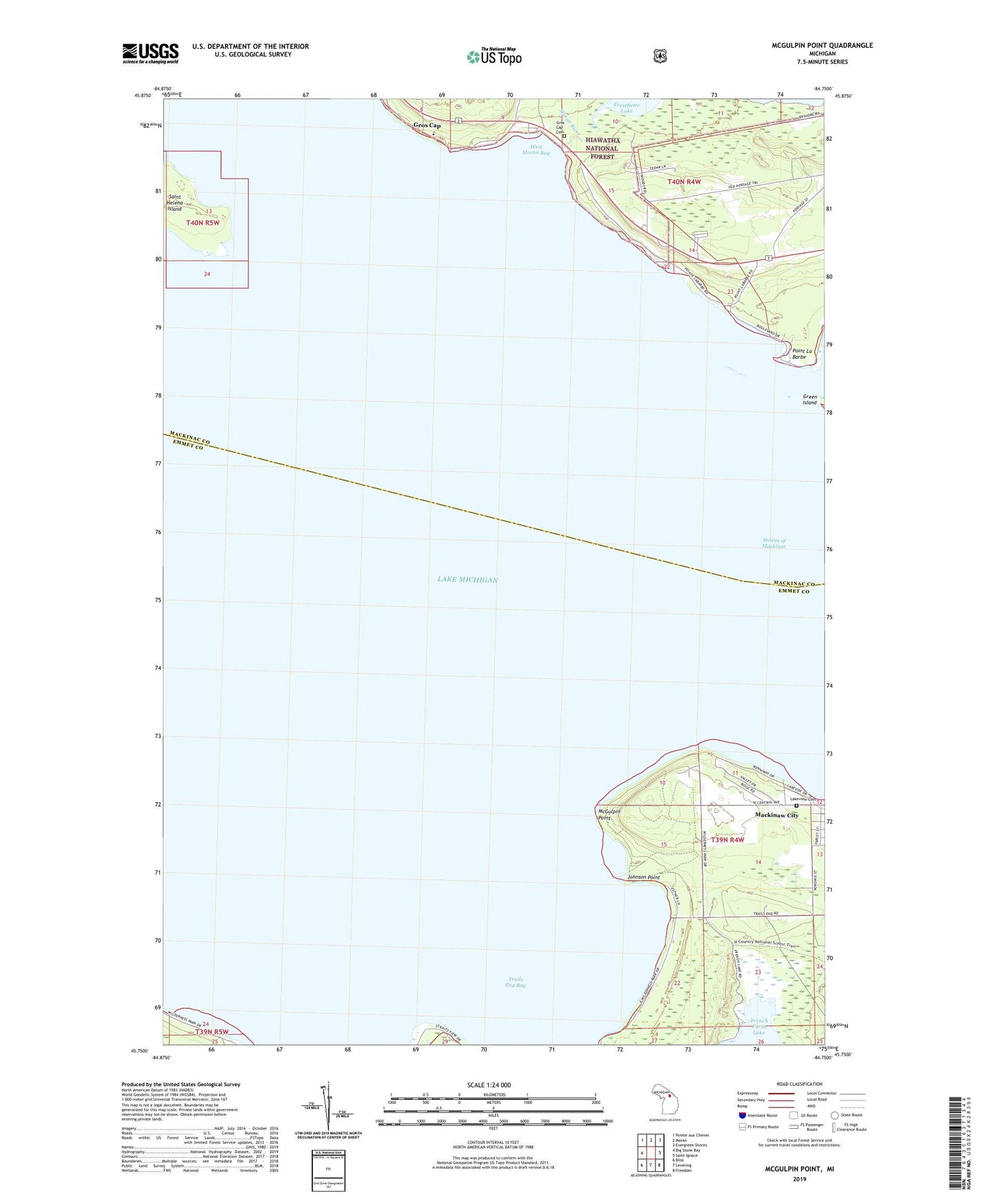
McGulpin Point Michigan US Topo Map
Couldn't load pickup availability
Also explore the McGulpin Point Forest Service Topo of this same quad for updated USFS data
2023 topographic map quadrangle McGulpin Point in the state of Michigan. Scale: 1:24000. Based on the newly updated USGS 7.5' US Topo map series, this map is in the following counties: Emmet, Mackinac. The map contains contour data, water features, and other items you are used to seeing on USGS maps, but also has updated roads and other features. This is the next generation of topographic maps. Printed on high-quality waterproof paper with UV fade-resistant inks.
Quads adjacent to this one:
West: Big Stone Bay
Northwest: Pointe aux Chenes
North: Moran
Northeast: Evergreen Shores
East: Saint Ignace
Southeast: Freedom
South: Levering
Southwest: Bliss
This map covers the same area as the classic USGS quad with code o45084g7.
Contains the following named places: Across the Peninsula Historical Marker, Freschette Lake, Gros Cap, Gros Cap and Saint Helena Island Historical Marker, Gros Cap Cemetery, Gros Cap School, Groscap Post Office, Johnson Point, Lake Michigan Historical Marker, Lakeshore RV Park Campground, Lakeview Cemetery, McGulpin Point, Moran River, Point La Barbe, Saint Helena Island, Springbrook Golf Club, Straits of Mackinac, Totem Village, Township of Wawatam, Trails End Bay, West Moran Bay, WIDG-AM (Saint Ignace), WMKC-FM (Saint Ignace)