MyTopo
Indianville Michigan US Topo Map
Couldn't load pickup availability
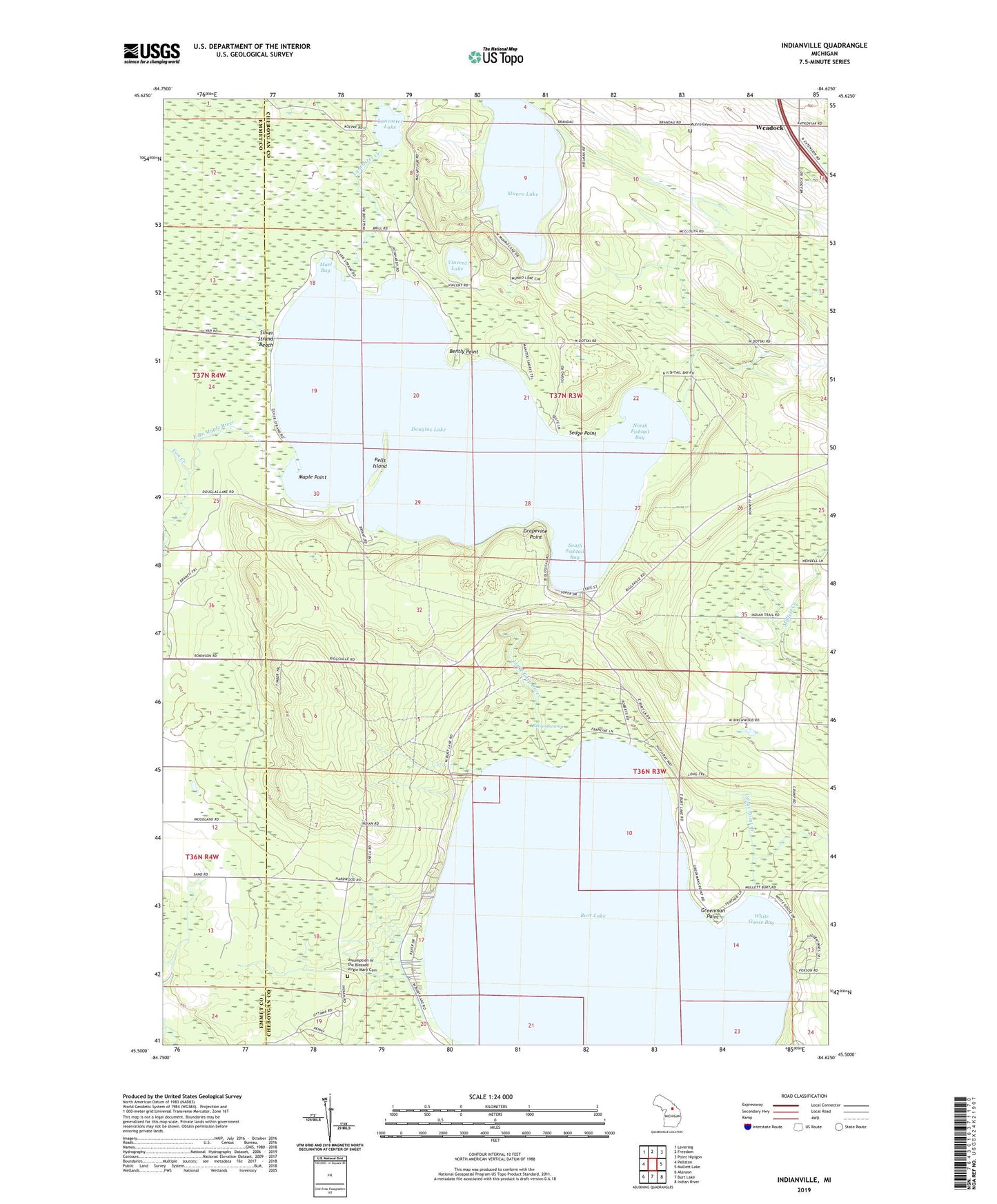
2023 topographic map quadrangle Indianville in the state of Michigan. Scale: 1:24000. Based on the newly updated USGS 7.5' US Topo map series, this map is in the following counties: Cheboygan, Emmet. The map contains contour data, water features, and other items you are used to seeing on USGS maps, but also has updated roads and other features. This is the next generation of topographic maps. Printed on high-quality waterproof paper with UV fade-resistant inks.
Quads adjacent to this one:
West: Pellston
Northwest: Levering
North: Freedom
Northeast: Point Nipigon
East: Mullett Lake
Southeast: Indian River
South: Burt Lake
Southwest: Alanson
This map covers the same area as the classic USGS quad with code o45084e6.
Contains the following named places: Assumption of the Blessed Virgin Mary Cemetery, Bently Point, Bryants Post Office, Camp Knight, Cedar Point Creek, Douglas Lake, Grapevine Point, Greenman Point, Indianville, Ingleside, Ingleside Post Office, Lancaster Creek, Lancaster Lake, Little Carp River, Maple Point, Marl Bay, Munro Cemetery, Munro Lake, North Fishtail Bay, Pells Island, Reeses Swamp, Saint Marys Church, Sedge Point, Silver Strand Beach, South Fishtail Bay, Township of Burt, Township of Munro, University of Michigan Biological Station, Vincent Lake, Weadock, Weadock Post Office, White Goose Bay, ZIP Code: 49716