MyTopo
Pellston Michigan US Topo Map
Couldn't load pickup availability
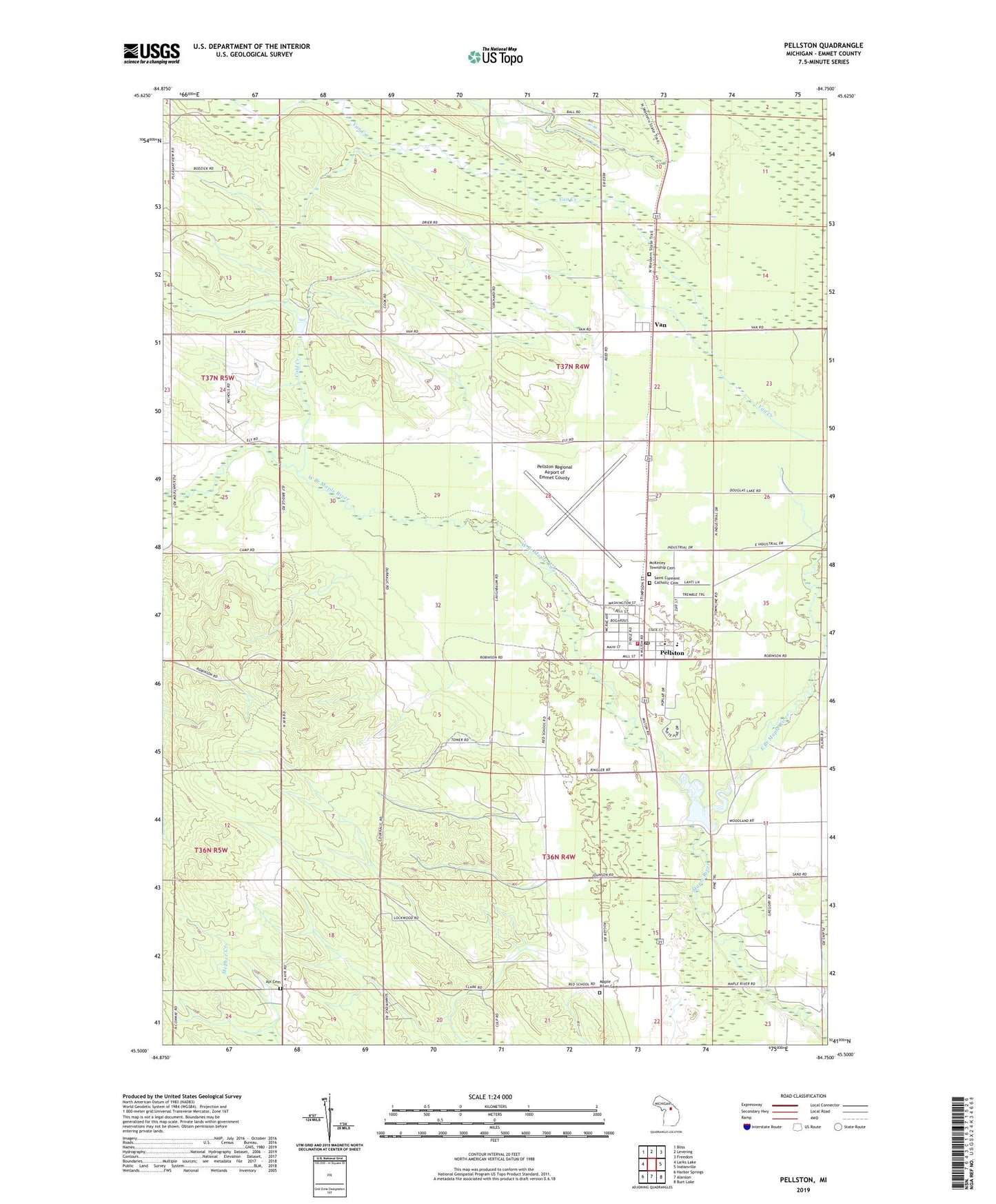
2023 topographic map quadrangle Pellston in the state of Michigan. Scale: 1:24000. Based on the newly updated USGS 7.5' US Topo map series, this map is in the following counties: Emmet. The map contains contour data, water features, and other items you are used to seeing on USGS maps, but also has updated roads and other features. This is the next generation of topographic maps. Printed on high-quality waterproof paper with UV fade-resistant inks.
Quads adjacent to this one:
West: Larks Lake
Northwest: Bliss
North: Levering
Northeast: Freedom
East: Indianville
Southeast: Burt Lake
South: Alanson
Southwest: Harbor Springs
This map covers the same area as the classic USGS quad with code o45084e7.
Contains the following named places: Ayr Cemetery, Cold Creek, East Branch Maple River, Ely Post Office, First Church, Grace Community Church, Hidden River Golf and Casting Club, Kingdom Hall of the Jehovah's Witnesses, Lake Kathleen, Liberty Baptist Church, Maple Ridge Golf Club, Maple River Cemetery, McKinley Township Cemetery, New Hope United Methodist Church, Pellston, Pellston Branch Library, Pellston Department of Natural Resources, Pellston Elementary School, Pellston Fire Department, Pellston High School, Pellston Lookout Tower, Pellston Park, Pellston Post Office, Pellston Regional Airport of Emmet County, Pellston Station, Pentecostal Church of God, Pioneer Park, Saint Clement Catholic Cemetery, Saint Clement Catholic Church, Spelling Park, Township of Maple River, Township of McKinley, Van, Van Creek, Van Post Office, Van Station, Village of Pellston, West Branch Maple River, Zion Church, ZIP Code: 49769