MyTopo
Garden Island West Michigan US Topo Map
Couldn't load pickup availability
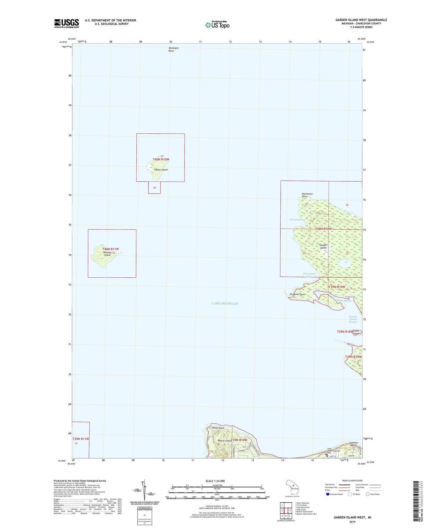
2023 topographic map quadrangle Garden Island West in the state of Michigan. Scale: 1:24000. Based on the newly updated USGS 7.5' US Topo map series, this map is in the following counties: Charlevoix. The map contains contour data, water features, and other items you are used to seeing on USGS maps, but also has updated roads and other features. This is the next generation of topographic maps. Printed on high-quality waterproof paper with UV fade-resistant inks.
Quads adjacent to this one:
West: Trout Island
Northwest: Point Patterson
East: Hog Island West
Southeast: Beaver Island North OE E
South: Beaver Island North
Southwest: High Island
This map covers the same area as the classic USGS quad with code o45085g5.
Contains the following named places: Bomways Bay, Garden Island Harbor, Grahams Point, Indian Cemetery, Indian Harbor, Indian Point, Jordan River State Forest, Little Island, Lookout Point, Ninneegoes Bay, Northwest Point, Saint James, Saint James Township Cemetery, Saint James Township Park, Squaw Island, Squaw Island Lighthouse, Township of Saint James, Whiskey Island