MyTopo
Beaver Island North Michigan US Topo Map
Couldn't load pickup availability
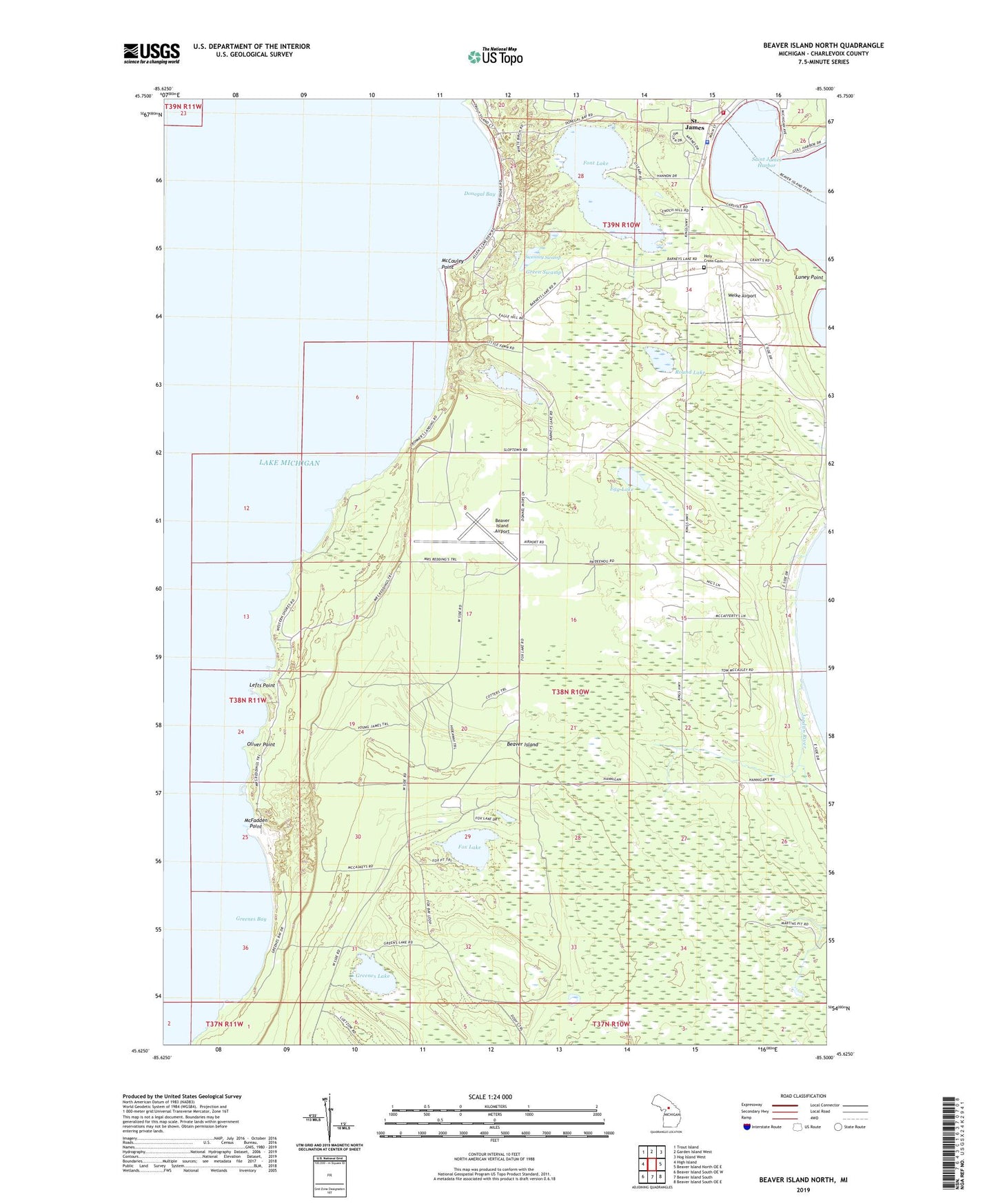
2023 topographic map quadrangle Beaver Island North in the state of Michigan. Scale: 1:24000. Based on the newly updated USGS 7.5' US Topo map series, this map is in the following counties: Charlevoix. The map contains contour data, water features, and other items you are used to seeing on USGS maps, but also has updated roads and other features. This is the next generation of topographic maps. Printed on high-quality waterproof paper with UV fade-resistant inks.
Quads adjacent to this one:
West: High Island
Northwest: Trout Island
North: Garden Island West
Northeast: Hog Island West
East: Beaver Island North OE E
Southeast: Beaver Island South OE E
South: Beaver Island South
Southwest: Beaver Island South OE W
This map covers the same area as the classic USGS quad with code o45085f5.
Contains the following named places: Barneys Lake, Beaver Harbor Lighthouse, Beaver Harbor Marina, Beaver Island, Beaver Island Airport, Beaver Island Campground, Beaver Island Emergency Medical Services, Beaver Island Fire Department Station 1, Beaver Island Harbor Lighthouse, Beaver Island Lookout Tower, Beaver Island Marine Museum, Beaver Island Post Office, Beaver Island Yacht Dock, Bonner Landing, Charlevoix County Sheriff's Office, Donegal Bay, Egg Lake, Font Lake, Fox Lake, Green Swamp, Greenes Bay, Greenes Lake, Holy Cross Cemetery, Holy Cross Church, Jordan River, Lefts Point, Little Sand Bay, Luney Point, McCauley Point, McFadden Point, Mormon Print Shop Historical Marker, Oliver Point, Roseville School, Round Lake, Saint James Census Designated Place, Saint James Harbor, Saint James Light, Sand Bay, Sunnyside School, Swenney Swamp, Township of Peaine, Welke Airport, ZIP Code: 49782