MyTopo
Northport Michigan US Topo Map
Couldn't load pickup availability
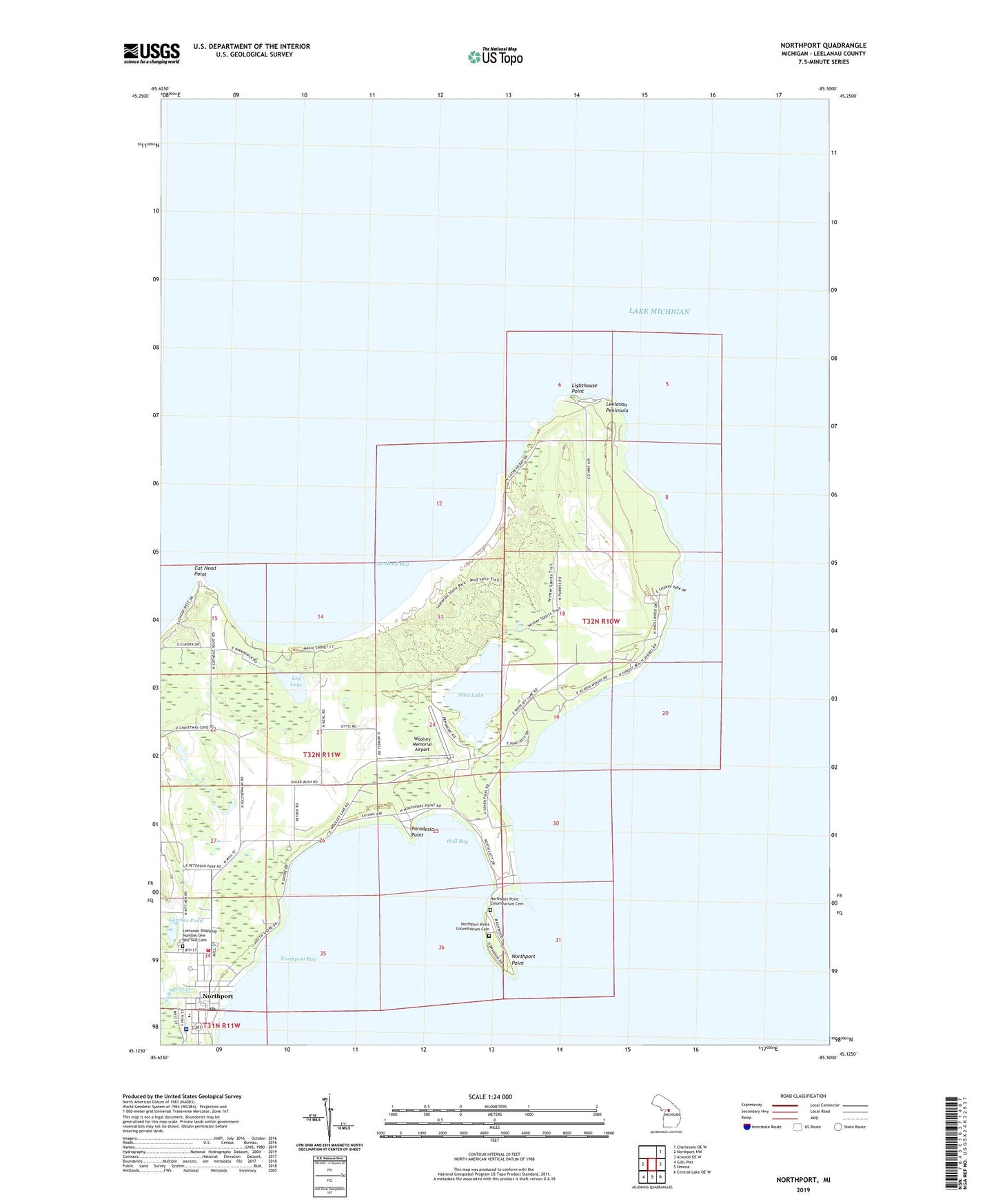
2023 topographic map quadrangle Northport in the state of Michigan. Scale: 1:24000. Based on the newly updated USGS 7.5' US Topo map series, this map is in the following counties: Leelanau. The map contains contour data, water features, and other items you are used to seeing on USGS maps, but also has updated roads and other features. This is the next generation of topographic maps. Printed on high-quality waterproof paper with UV fade-resistant inks.
Quads adjacent to this one:
West: Northport NW
Northeast: Charlevoix OE W
East: Atwood OE W
Southeast: Central Lake OE W
South: Omena
Southwest: Gills Pier
This map covers the same area as the classic USGS quad with code o45085b5.
Contains the following named places: Atwill Memorial Chapel Cemetery, Bay Front Park, Bethany Lutheran Church, Cat Head Bay, Cat Head Point, Cherry Home Post Office, Craker Boat Yard, G Marsten Dame Marina, Garthes Pond, Grand Traverse Light, Great Lakes Sport Fishery Historical Marker, Hall Bay, Haserot Park, Leelanau Memorial Health Center, Leelanau Peninsula, Leelanau State Park, Leelanau Township Fire Department, Leelanau Township Library, Leelanau Township Number One and Two Cemetery, Leg Lake, Lighthouse Point, Mud Lake, Northport, Northport Bay Boat Yard, Northport Creek, Northport Medical Clinic, Northport Park, Northport Point, Northport Point Columbarium Cemetery, Northport Point Golf Club, Northport Point Post Office, Northport Post Office, Northport Public School, Northport Station, Paradesia Point, Saint Gertrude Church, Trinity Church, Village of Northport, Woolsey Memorial Airport