MyTopo
Hanover Michigan US Topo Map
Couldn't load pickup availability
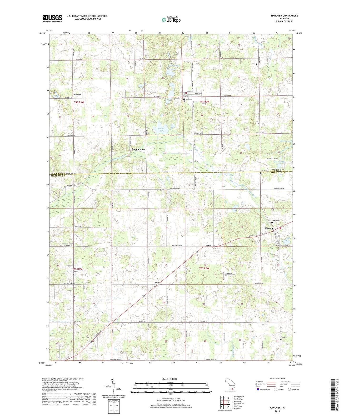
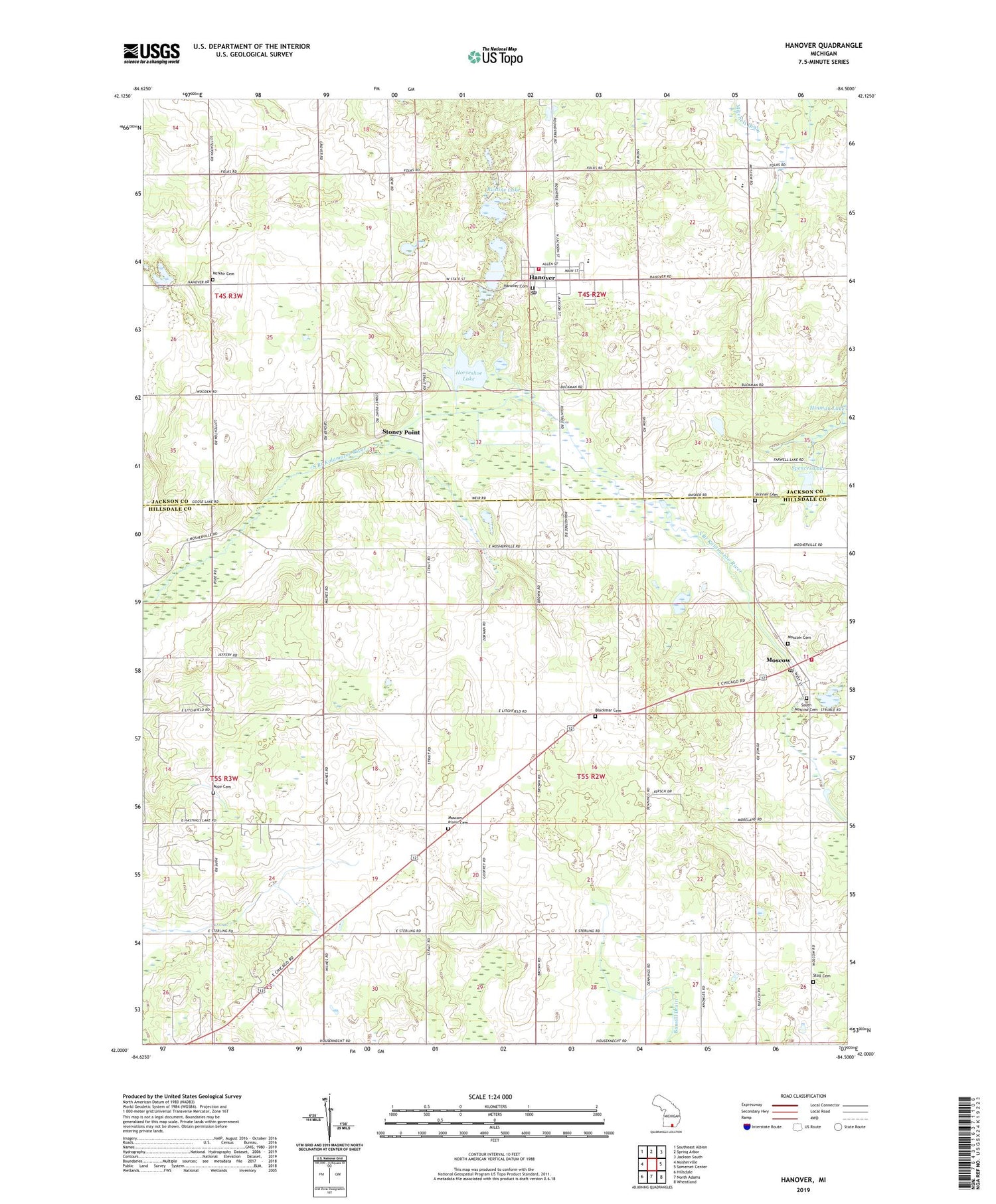
2019 topographic map quadrangle Hanover in the state of Michigan. Scale: 1:24000. Based on the newly updated USGS 7.5' US Topo map series, this map is in the following counties: Hillsdale, Jackson. The map contains contour data, water features, and other items you are used to seeing on USGS maps, but also has updated roads and other features. This is the next generation of topographic maps. Printed on high-quality waterproof paper with UV fade-resistant inks.
Quads adjacent to this one:
West: Mosherville
Northwest: Southeast Albion
North: Spring Arbor
Northeast: Jackson South
East: Somerset Center
Southeast: Wheatland
South: North Adams
Southwest: Hillsdale
Contains the following named places: Bansill Drain, Bibbons Lake, Blackmar Cemetery, Buck Lake, Cavanaugh Drain, Clapp School, Conklin Reed Organ and History Museum, Day School, Granger School, Hanover, Hanover Baptist Church, Hanover Cemetery, Hanover High School Historical Marker, Hanover Post Office, Hanover Station, Hanover Township Fire Department Station 1, Hanover-Horton Elementary School, Hanover-Horton High School, Hanover-Horton Middle School, Hanover-Horton Schools Historical Marker, Hillside Church, Horseshoe Lake, Jackson District Library-Hanover Branch, McNair Cemetery, McNair School, Michigan and Ohio Railroad Depot Historical Marker, Mill Pond, Milnes School, Moscow, Moscow Plains Cemetery, Moscow Plains Church, Moscow Post Office, Moscow Station, Moscow Township Fire Department, Munford School, Old Soldier Cemetery, Pope Cemetery, Rice Cemetery, Rustine Lake, Scipio Post Office, Scipio School, Scipio Station, Skinner Cemetery, Spencer Lake, Spring Valley Estates Mobile Home Park, Stoll Cemetery, Stoney Point, Stoney Point Station, Stonypoint Post Office, Township of Hanover, Township of Moscow, Village of Hanover, ZIP Code: 49241