MyTopo
Hughes Point Michigan US Topo Map
Couldn't load pickup availability
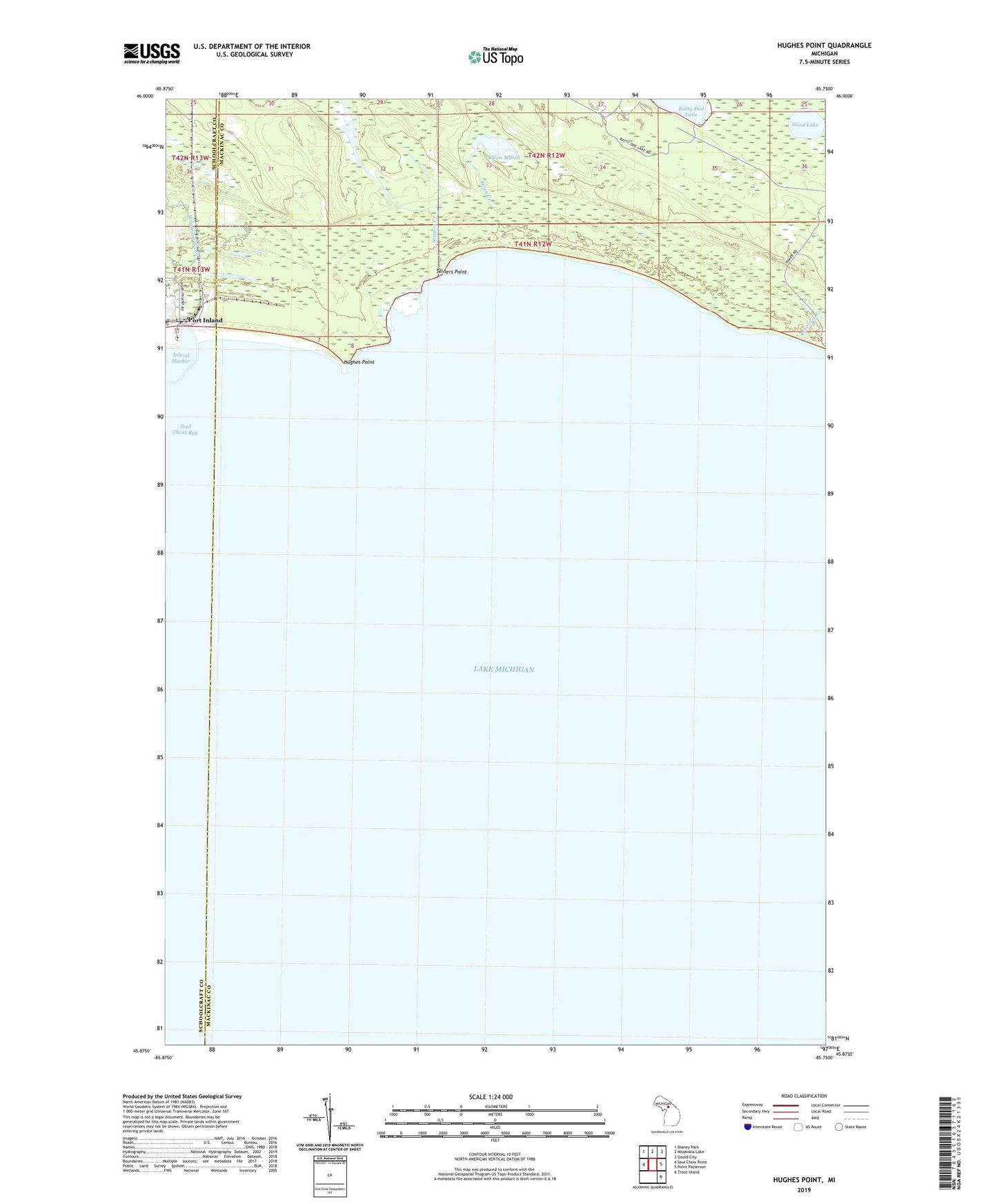
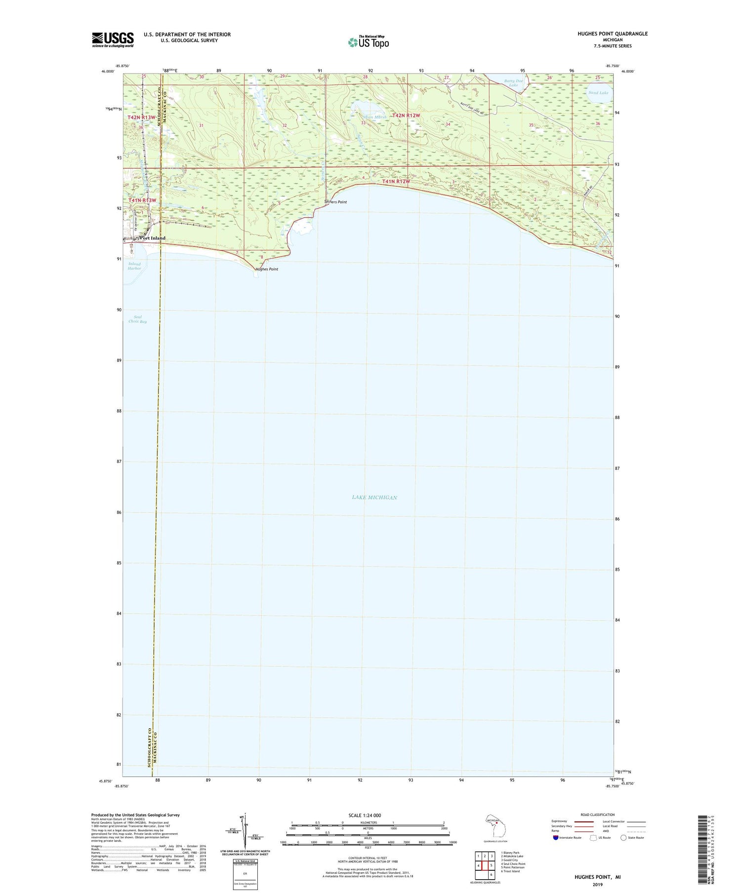
2019 topographic map quadrangle Hughes Point in the state of Michigan. Scale: 1:24000. Based on the newly updated USGS 7.5' US Topo map series, this map is in the following counties: Mackinac, Schoolcraft. The map contains contour data, water features, and other items you are used to seeing on USGS maps, but also has updated roads and other features. This is the next generation of topographic maps. Printed on high-quality waterproof paper with UV fade-resistant inks.
Quads adjacent to this one:
West: Seul Choix Point
Northwest: Blaney Park
North: Milakokia Lake
Northeast: Gould City
East: Point Patterson
Southeast: Trout Island
Contains the following named places: Hughes Point, Inland Harbor, Peterson Creek, Port Inland, Sand Lake, Seiners Creek, Seiners Point, Swan Creek, Swan Marsh