MyTopo
Seul Choix Point Michigan US Topo Map
Couldn't load pickup availability
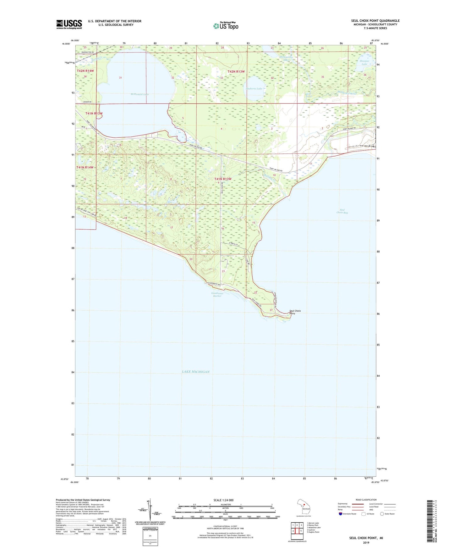
2023 topographic map quadrangle Seul Choix Point in the state of Michigan. Scale: 1:24000. Based on the newly updated USGS 7.5' US Topo map series, this map is in the following counties: Schoolcraft. The map contains contour data, water features, and other items you are used to seeing on USGS maps, but also has updated roads and other features. This is the next generation of topographic maps. Printed on high-quality waterproof paper with UV fade-resistant inks.
Quads adjacent to this one:
West: Gulliver
Northwest: Merwin Lake
North: Blaney Park
Northeast: Milakokia Lake
East: Hughes Point
This map covers the same area as the classic USGS quad with code o45085h8.
Contains the following named places: Anderson Creek, Bulldog Creek, Fernia Creek, Goadreaus Harbor, McDonald Lake, Milakokia River, Millaquaka Lake, Seul Choix Bay, Seul Choix Point, Seul Choix Point Lighthouse, Shoepac Lake, Shuberts Lake, Stone Rapids