MyTopo
Blaney Park Michigan US Topo Map
Couldn't load pickup availability
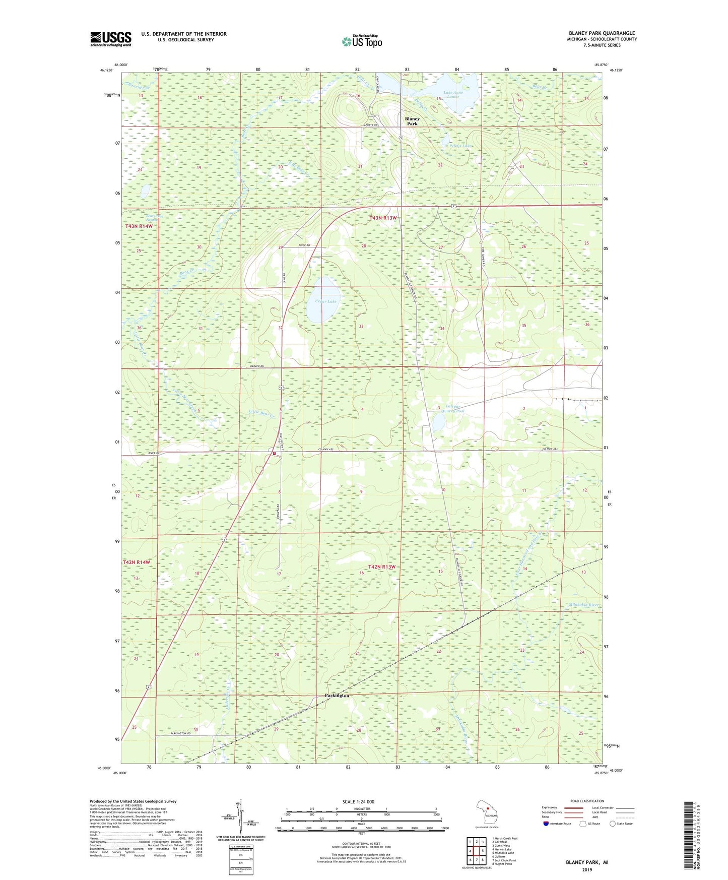
2023 topographic map quadrangle Blaney Park in the state of Michigan. Scale: 1:24000. Based on the newly updated USGS 7.5' US Topo map series, this map is in the following counties: Schoolcraft. The map contains contour data, water features, and other items you are used to seeing on USGS maps, but also has updated roads and other features. This is the next generation of topographic maps. Printed on high-quality waterproof paper with UV fade-resistant inks.
Quads adjacent to this one:
West: Merwin Lake
Northwest: Marsh Creek Pool
North: Germfask
Northeast: Curtis West
East: Milakokia Lake
Southeast: Hughes Point
South: Seul Choix Point
Southwest: Gulliver
This map covers the same area as the classic USGS quad with code o46085a8.
Contains the following named places: Bear Creek Swamp, Blaney Junction, Blaney Park, Blaney Park Post Office, Calspar Post Office, Calspar Quarry Pool, Cedar Lake, Divine Infant of Prague Church, East Branch Bear Creek, Four Hundred and Five Creek, Lake Anne Louise, Little Bear Creek, Maple Grove Church, Parkington, Parkington Post Office, Parkington Station, Pelky Creek, Pelkys Lake, Township of Mueller