MyTopo
Gould City Michigan US Topo Map
Couldn't load pickup availability
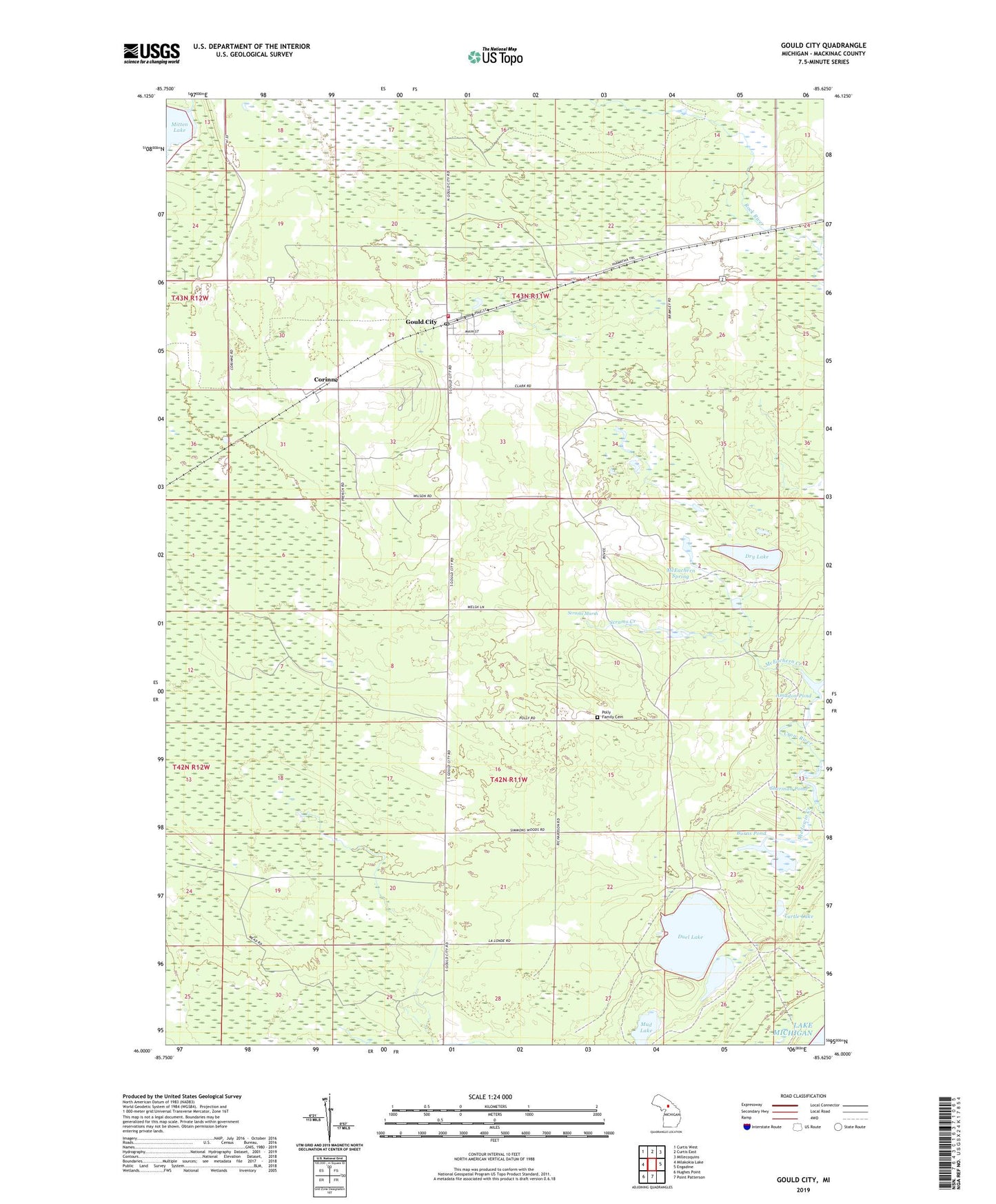
2023 topographic map quadrangle Gould City in the state of Michigan. Scale: 1:24000. Based on the newly updated USGS 7.5' US Topo map series, this map is in the following counties: Mackinac. The map contains contour data, water features, and other items you are used to seeing on USGS maps, but also has updated roads and other features. This is the next generation of topographic maps. Printed on high-quality waterproof paper with UV fade-resistant inks.
Quads adjacent to this one:
West: Milakokia Lake
Northwest: Curtis West
North: Curtis East
Northeast: Millecoquins
East: Engadine
South: Point Patterson
Southwest: Hughes Point
This map covers the same area as the classic USGS quad with code o46085a6.
Contains the following named places: Amadon Pond, Bovee Post Office, Bovee Station, Browns Lake, Burns Pond, Corinne, Corinne Station, Crow River, Dry Lake, Duel Lake, Gould City, Gould City Post Office, Gould City Station, McEachern Creek, McEachern Spring, Mud Lake, Newton Township Fire Department, Polly Family Cemetery, Scrams Creek, Scrams Marsh, Shedowin Creek, Sherman Pond, Township of Newton, Turtle Lake, Viola Post Office, ZIP Code: 49838