
MyTopo
Indian Town Michigan US Topo Map
Couldn't load pickup availability
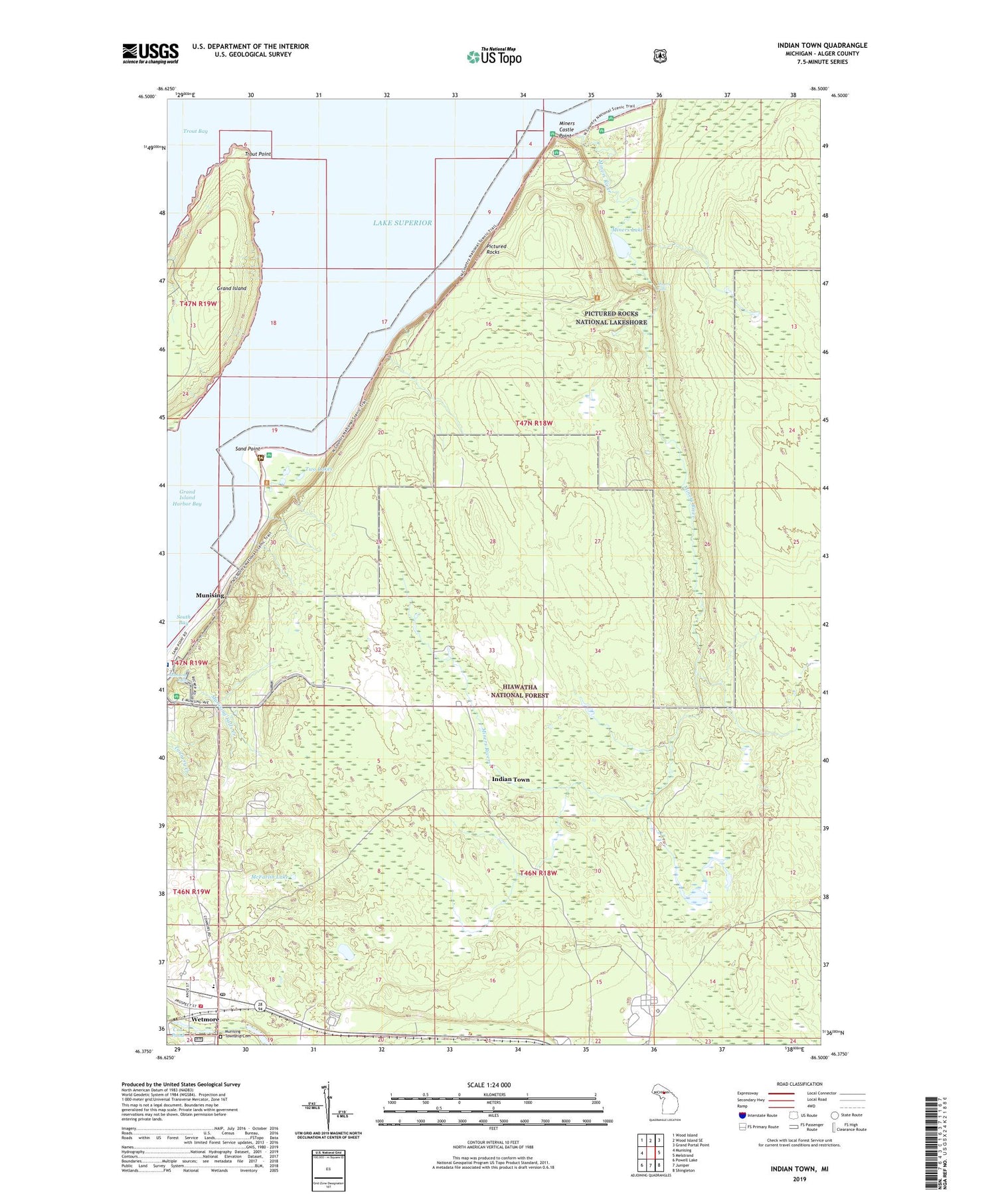
2019 topographic map quadrangle Indian Town in the state of Michigan. Scale: 1:24000. Based on the newly updated USGS 7.5' US Topo map series, this map is in the following counties: Alger. The map contains contour data, water features, and other items you are used to seeing on USGS maps, but also has updated roads and other features. This is the next generation of topographic maps. Printed on high-quality waterproof paper with UV fade-resistant inks.
Quads adjacent to this one:
West: Munising
Northwest: Wood Island
North: Wood Island SE
Northeast: Grand Portal Point
East: Melstrand
Southeast: Shingleton
South: Juniper
Southwest: Powell Lake
Contains the following named places: Cox Pond, Grand Island Harbor Lighthouse, Indian Town, McFarlin Lake, Miners Castle Point, Miners Falls, Miners Lake, Miners River, Munising Baptist Church, Munising Falls, Munising Township Cemetery, Munising Township Fire Department, Nelson Lake, Pictured Rocks Golf and Country Club, Sand Point, Township of Munising, Trout Point, Two Lakes, Wandering Wheels Campground, Wetmore, Wetmore Post Office, Wetmore Station


