MyTopo
Munising Michigan US Topo Map
Couldn't load pickup availability
Also explore the Munising Forest Service Topo of this same quad for updated USFS data
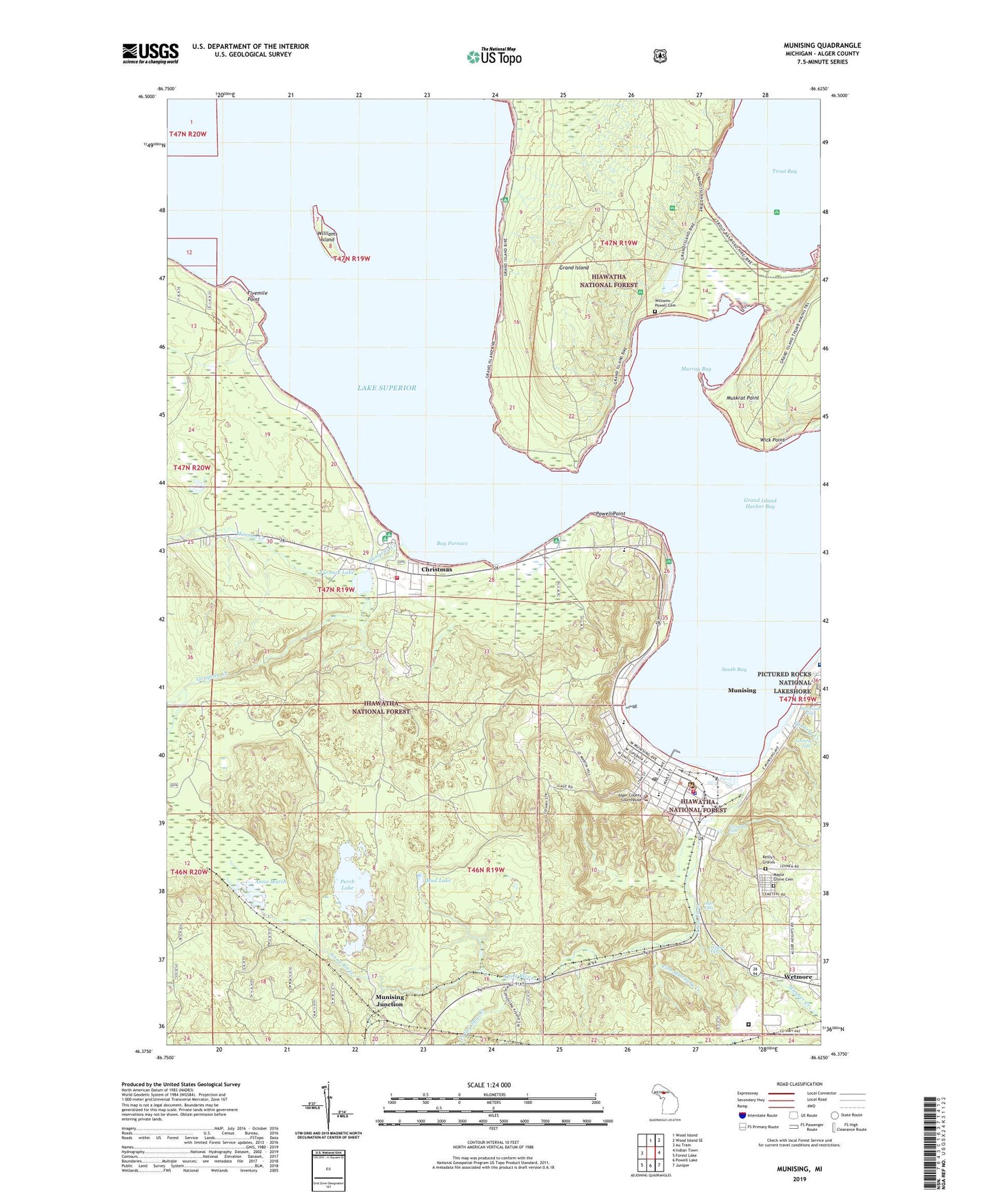
2023 topographic map quadrangle Munising in the state of Michigan. Scale: 1:24000. Based on the newly updated USGS 7.5' US Topo map series, this map is in the following counties: Alger. The map contains contour data, water features, and other items you are used to seeing on USGS maps, but also has updated roads and other features. This is the next generation of topographic maps. Printed on high-quality waterproof paper with UV fade-resistant inks.
Quads adjacent to this one:
West: Au Train
North: Wood Island
Northeast: Wood Island SE
East: Indian Town
Southeast: Juniper
South: Powell Lake
Southwest: Forest Lake
This map covers the same area as the classic USGS quad with code o46086d6.
Contains the following named places: Alger Correctional Facility, Alger County Courthouse, Alger County Heritage Center, Alger County Sheriff Department Emergency Medical Services, Alger County Sheriff's Office, Alger Falls, Anna Marsh, Anna River, Bay Care Medical Center, Bay Furnace, Bay Furnace Lighthouse, Bay Furnace Recreation Area, Central Elementary School, Christmas, City of Munising, Coty Lakeshore Recreation Area, Duck Lake, Eden Evangelical Lutheran Church, Faith Baptist Church, First Presbyterian Church, Fish Hatchery Creek, Fivemile Point, Furnace Lake, Gogarnville Post Office, Gongeau Creek, Grand Island Harbor Bay, Hallston Post Office, Hallston Station, Hanson Creek, Horseshoe Falls, Indian Cemetery, Island View Estates Mobile Park, Lobb House Historical Marker, Maple Grove Cemetery, Maple Mountain Ski Area, Memorial Falls, Mud Lake, Munising, Munising City Dock, Munising City Hall, Munising Falls Creek, Munising Front and Rear Range Lighthouse, Munising Junction, Munising Junction Station, Munising Memorial Hospital, Munising Middle - High School, Munising Police Department, Munising Post Office, Munising Public Library, Munising Ranger District, Munising Station, Munising Volunteer Fire Department, Munising Wesleyan Church, Murray Bay, Muskrat Point, Perch Lake, Powell Point, Reilly's Graves, Sacred Heart Church, Saint John's Episcopal Church, Seventh-day Adventist School, South Bay, Tannery Creek, Tannery Falls, Trout Bay, United Methodist Church, Valley Spur Creek, Wagner Creek, Wagner Falls, Wagner Falls State Scenic Site, Wick Point, Williams Island, Williams Landing, Williams-Powell Cemetery, WQXO-AM (Munising), WQXO-FM (Munising), ZIP Code: 49862


