MyTopo
Powell Lake Michigan US Topo Map
Couldn't load pickup availability
Also explore the Powell Lake Forest Service Topo of this same quad for updated USFS data
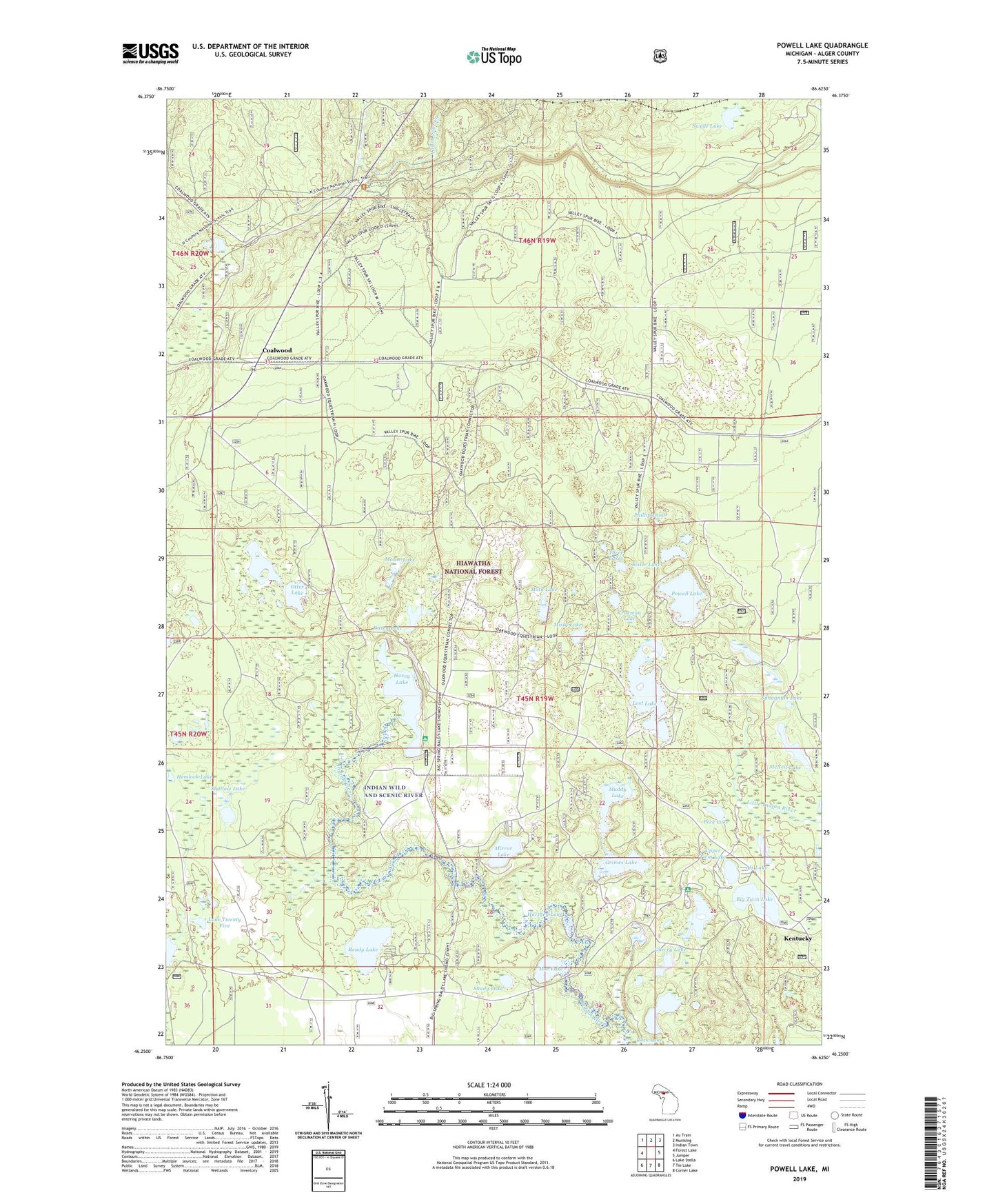
2023 topographic map quadrangle Powell Lake in the state of Michigan. Scale: 1:24000. Based on the newly updated USGS 7.5' US Topo map series, this map is in the following counties: Alger. The map contains contour data, water features, and other items you are used to seeing on USGS maps, but also has updated roads and other features. This is the next generation of topographic maps. Printed on high-quality waterproof paper with UV fade-resistant inks.
Quads adjacent to this one:
West: Forest Lake
Northwest: Au Train
North: Munising
Northeast: Indian Town
East: Juniper
Southeast: Corner Lake
South: Tie Lake
Southwest: Lake Stella
This map covers the same area as the classic USGS quad with code o46086c6.
Contains the following named places: Als Lake, Big Twin Lake, Buckhorn/Otter Lake Campground, CCC Camp, Cherry Lake, Coalwood, Coalwood Post Office, Coalwood Recreational Trail, Coalwood Station, Doe Lake, Grimes Lake, Halfmoon Lake, Hartney Lake, Hemlock Lake, Hovey Lake, Hovey Lake Campground, Island Lake, Island Lake Campground, Kentucky, Kitten Lake, Lake Twenty Five, Lost Lake, McNeil Lake, Mirror Lake, Misty Lake, Moth Lake, Mouse Lake, Muddy Lake, Otter Lake, Peck Lake, Phillip Pond, Powell Lake, Ready Lake, Shady Lake, Shallow Lake, Sister Lake, Sphagnum Lake, Swede Lake, Three Lakes, Trueman Lake, Upper Twin Lake, Valley Spur Ski Trail