MyTopo
Kinderhook Michigan US Topo Map
Couldn't load pickup availability
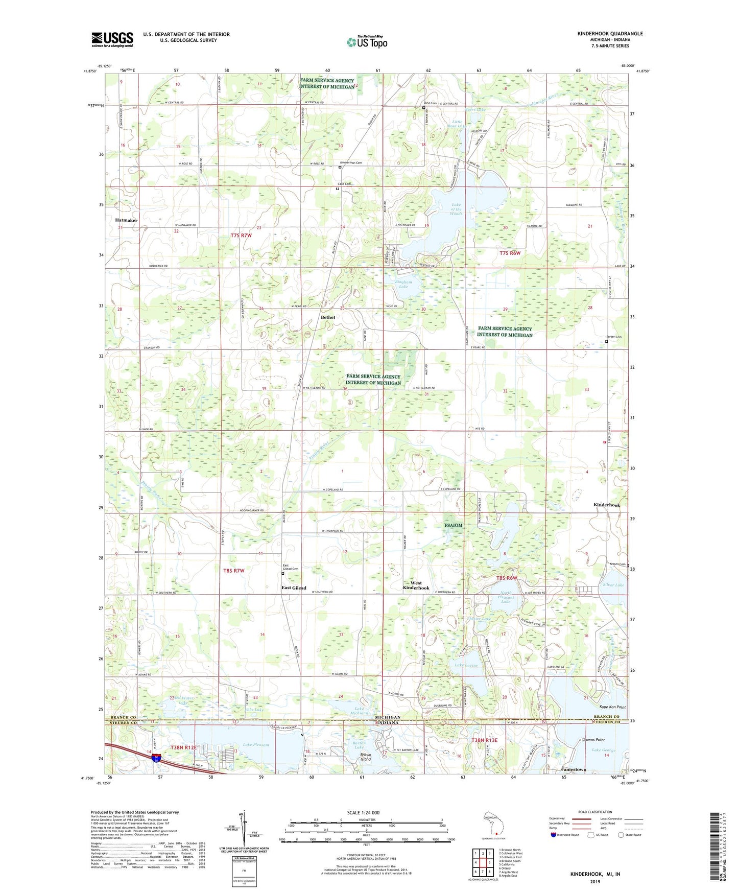
2019 topographic map quadrangle Kinderhook in the states of Michigan, Indiana. Scale: 1:24000. Based on the newly updated USGS 7.5' US Topo map series, this map is in the following counties: Branch, Steuben. The map contains contour data, water features, and other items you are used to seeing on USGS maps, but also has updated roads and other features. This is the next generation of topographic maps. Printed on high-quality waterproof paper with UV fade-resistant inks.
Quads adjacent to this one:
West: Bronson South
Northwest: Bronson North
North: Coldwater West
Northeast: Coldwater East
East: California
Southeast: Angola East
South: Angola West
Southwest: Orland
Contains the following named places: Ammerman Cemetery, Barton Lake, Bethel, Bethel Gilead Community Church, Bethel Post Office, Bingham Lake, Brown Island, Browns Point, Byers Lake, Card Cemetery, Chester Lake, Dragon Lake, East Gilead, East Gilead Cemetery, East Gilead Missionary Church, East Gilead Post Office, Green Acres Campground, Hatmaker, Hatmaker Post Office, Hog Lake, Kinderhook, Kinderhook Post Office, Knauss Cemetery, Kope Kon Point, Lake George, Lake George Dam, Lake Lavine, Lake Michiana, Lake of the Woods, Lake Pleasant, Lakeland Volunteer Fire Department, Little Fawn River, Little Rose Lake, Long Beach Lake, North Pleasant Lake, Ovid Cemetery, Ovid Post Office, Red Water Lake, School Number 6, Snow Prairie School, Sorter Cemetery, Township of Bethel, Township of Gilead, Township of Kinderhook, Township of Ovid, Vohs Lake, West Kinderhook