MyTopo
Orland Indiana US Topo Map
Couldn't load pickup availability
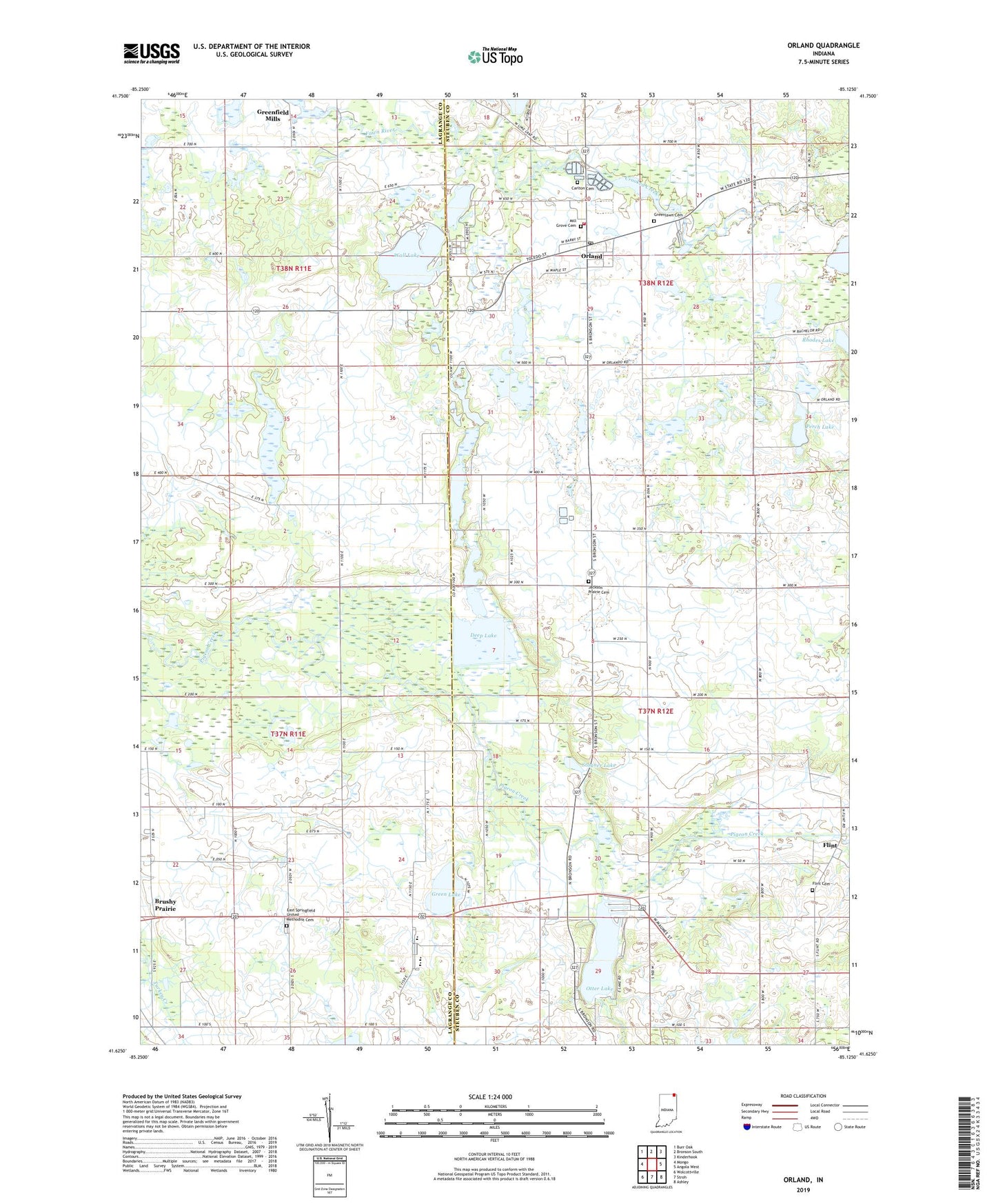
2022 topographic map quadrangle Orland in the state of Indiana. Scale: 1:24000. Based on the newly updated USGS 7.5' US Topo map series, this map is in the following counties: Steuben, LaGrange. The map contains contour data, water features, and other items you are used to seeing on USGS maps, but also has updated roads and other features. This is the next generation of topographic maps. Printed on high-quality waterproof paper with UV fade-resistant inks.
Quads adjacent to this one:
West: Mongo
Northwest: Burr Oak
North: Bronson South
Northeast: Kinderhook
East: Angola West
Southeast: Ashley
South: Stroh
Southwest: Wolcottville
This map covers the same area as the classic USGS quad with code o41085f2.
Contains the following named places: Beaverdam Lake, Brown Lake, Brushy Prairie, Carlton Cemetery, Charity United Baptist Church, Crooked Creek, Deep Lake, East Springfield Church, East Springfield United Methodist Cemetery, East Springfield United Methodist Church, Fawn River Fish Hatchery, Flint, Flint Cemetery, Grassy Lake, Green Lake, Greenlawn Cemetery, Jackson Prairie Cemetery, Mill Grove Cemetery, Orland, Orland Post Office, Orland Volunteer Fire Department and Rescue, Otter Lake, Perch Lake, Prairie Heights School, Rhodes Lake, Shallow Lake, Stayner Lake, Tamarack Lake, Town of Orland, Township of Jackson, Township of Millgrove, Wall Lake, Warner Lake, ZIP Code: 46776