MyTopo
Bronson South Michigan US Topo Map
Couldn't load pickup availability
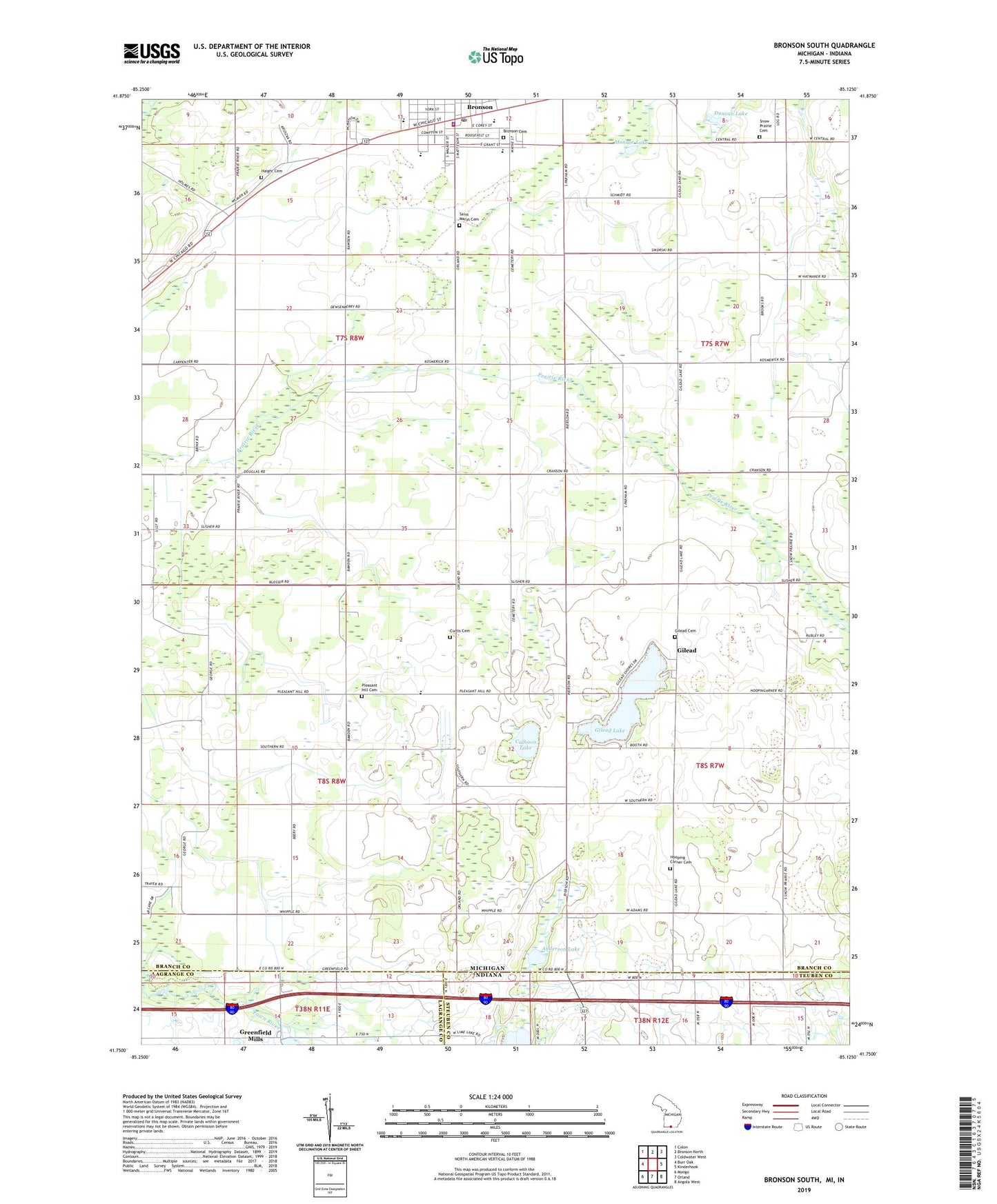
2023 topographic map quadrangle Bronson South in the states of Michigan, Indiana. Scale: 1:24000. Based on the newly updated USGS 7.5' US Topo map series, this map is in the following counties: Branch, Steuben, LaGrange. The map contains contour data, water features, and other items you are used to seeing on USGS maps, but also has updated roads and other features. This is the next generation of topographic maps. Printed on high-quality waterproof paper with UV fade-resistant inks.
Quads adjacent to this one:
West: Burr Oak
Northwest: Colon
North: Bronson North
Northeast: Coldwater West
East: Kinderhook
Southeast: Angola West
South: Orland
Southwest: Mongo
This map covers the same area as the classic USGS quad with code o41085g2.
Contains the following named places: Anderson Lake, Anderson School, Bronson, Bronson Cemetery, Bronson Family Health Center, Bronson Fire Department, Bronson Junior Senior High School, Bronson Police Department, Bronson Post Office, Bronson Public Library, Bronson Public Library Historical Marker, Calhoon Lake, Chicago Road Historical Marker, Chicago Street School, Church of Christ at Bronson, City of Bronson, Curtis Cemetery, Douglas Park, Duncan Lake, First Baptist Church, First Congregational Church, First United Methodist Church, Gilead, Gilead Lake, Gilead Post Office, Greenfield Mills, Greenfield Reservoir, Greenfield Reservoir Dam, Greenwald Park, Haight Cemetery, Hickory Corners School, Lime Lake, Monroe Lake, Noble Post Office, North Gilead Cemetery, Pleasant Hill Cemetery, Pleasant Hill Church, Prairie River Golf Club, Ryan School, Saint Marys Cemetery, Saint Marys School, Snow Prairie Cemetery, South Gilead Hoopingerner Cemetery, Township of Bronson, Township of Noble, Westbrook Home, ZIP Code: 49028